
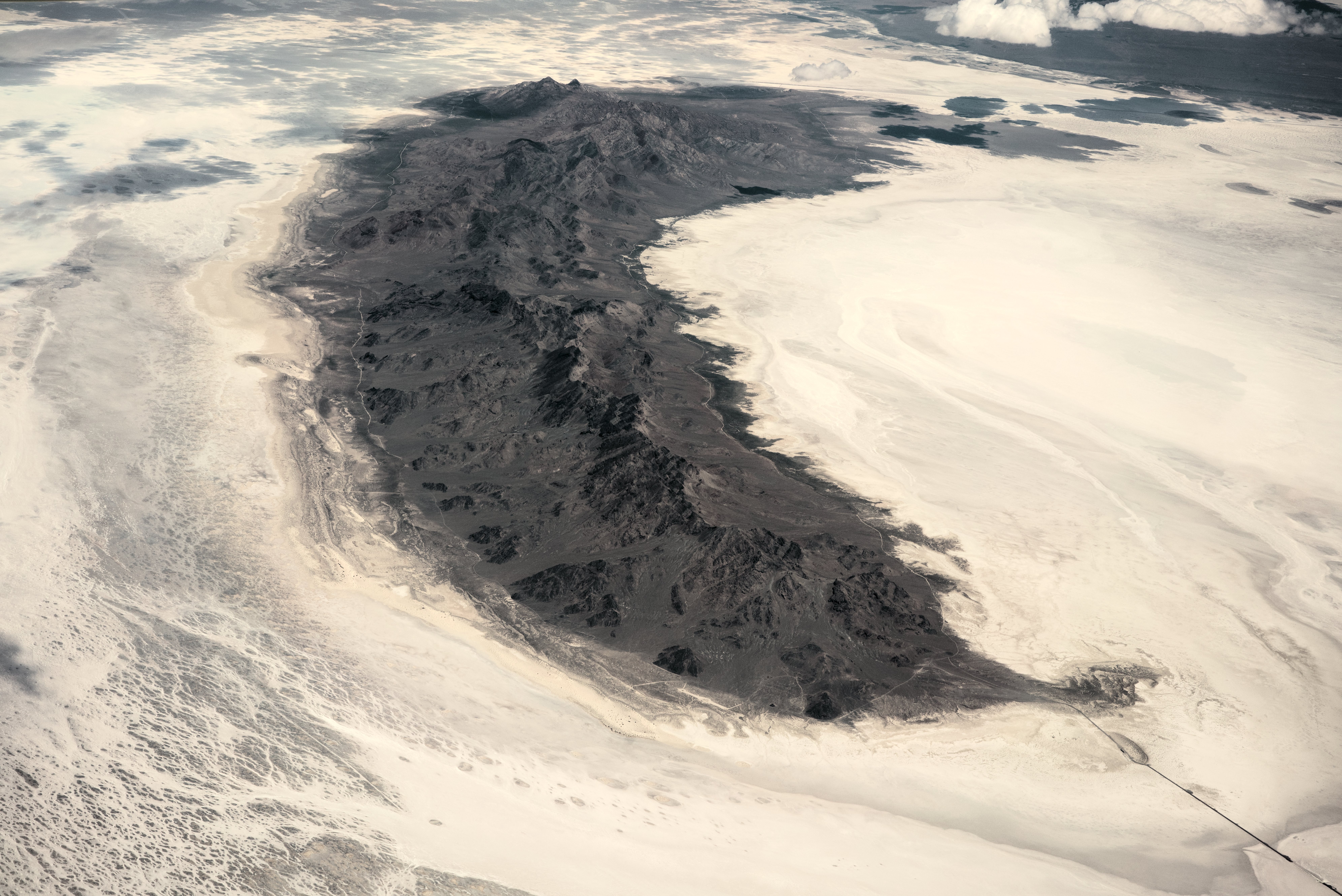
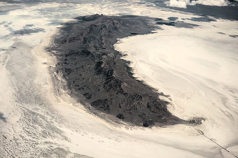
Image: Aerial view of Newfoundland Mountains from the south dllu
Size of this preview: 800 × 534 pixels. Other resolutions: 320 × 214 pixels | 7,968 × 5,320 pixels.
Original image (7,968 × 5,320 pixels, file size: 6.66 MB, MIME type: image/jpeg)
Description: The Newfoundland Mountains in Utah is a mountain range located in Box Elder County. The highest point on this range is known as Desert Peak [1] (not to be confused with the Deseret Peak or the Desert Peak Formation, Nevada). This aerial photo was taken from a commercial flight from Salt Lake City to San Francisco.
Title: Aerial view of Newfoundland Mountains from the south dllu
Credit: Own work
Author: Daniel L. Lu (user:dllu)
Usage Terms: Creative Commons Attribution-Share Alike 4.0
License: CC BY-SA 4.0
License Link: https://creativecommons.org/licenses/by-sa/4.0
Attribution Required?: Yes
Image usage
The following page links to this image:

All content from Kiddle encyclopedia articles (including the article images and facts) can be freely used under Attribution-ShareAlike license, unless stated otherwise.