
Image: Aerial - Wanapum Dam to Vantage, WA, Columbia River 01 - white balanced (9793434594)

Size of this preview: 800 × 531 pixels. Other resolutions: 320 × 213 pixels | 4,288 × 2,848 pixels.
Original image (4,288 × 2,848 pixels, file size: 8.73 MB, MIME type: image/jpeg)
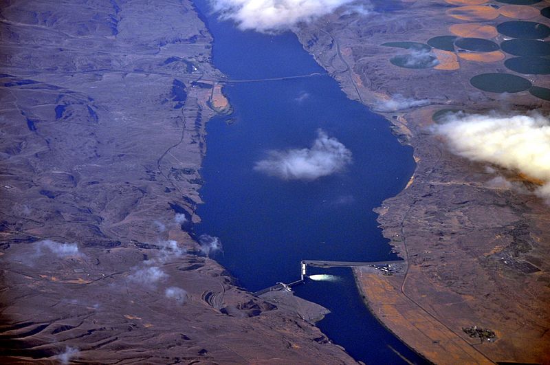
Description: Aerial view of Columbia River roughly from Wanapum Dam to the Vantage Bridge, near Vantage, Washington.
Title: Aerial - Wanapum Dam to Vantage, WA, Columbia River 01 - white balanced (9793434594)
Credit: Aerial - Wanapum Dam to Vantage, WA, Columbia River 01 - white balanced
Author: Joe Mabel (on Flickr as Joe Mabel from Seattle, US)
Permission: You may select the license of your choice.
Usage Terms: Creative Commons Attribution-Share Alike 3.0
License: CC BY-SA 3.0
License Link: https://creativecommons.org/licenses/by-sa/3.0
Attribution Required?: Yes
Image usage
The following page links to this image:

All content from Kiddle encyclopedia articles (including the article images and facts) can be freely used under Attribution-ShareAlike license, unless stated otherwise.
.jpg)