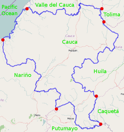
Image: Administrative context for Cauca Department, Colombia
Administrative_context_for_Cauca_Department,_Colombia.png (426 × 453 pixels, file size: 84 KB, MIME type: image/png)
Description: Created using MWSnap and GIMP. Red dots indicate where administrative boundaries intersect. The underlying image is from OpenStreetMap; see http://www.openstreetmap.org/?lat=2.34&lon=-76.73&zoom=8&layers=M&relation=1392085 .
Title: Administrative context for Cauca Department, Colombia
Credit: Own work
Author: Ceyockey
Usage Terms: Creative Commons Zero, Public Domain Dedication
License: CC0
License Link: http://creativecommons.org/publicdomain/zero/1.0/deed.en
Attribution Required?: No
Image usage
The following page links to this image:

All content from Kiddle encyclopedia articles (including the article images and facts) can be freely used under Attribution-ShareAlike license, unless stated otherwise.

