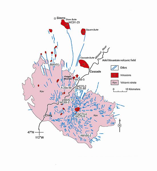
Image: Adel volcanics

Size of this preview: 551 × 600 pixels. Other resolutions: 220 × 240 pixels | 1,661 × 1,808 pixels.
Original image (1,661 × 1,808 pixels, file size: 689 KB, MIME type: image/jpeg)
Description: Simplified geologic map of the Adel Mountain volcanic field. From: Stephen S. Harlan, Lawrence W. Snee, Mitchell W. Reynolds, Harald H. Mehnert, R.G. Schmidt, Steve D. Sheriff, and Anthony J. Irving. "40Ar/39Ar and K-Ar Geochronology and Tectonic Significance of the Upper Cretaceous Adel Mountain Volcanics and Spatially Associated Tertiary Igneous Rocks, Northwestern Montana." Professional Paper 1696. U.S. Department of the Interior, U.S. Geological Survey. Reston, Virginia: 2005
Title: Adel volcanics
Credit: http://pubs.usgs.gov/pp/2005/1696/pdf/PP1696.pdf
Author: U.S. Geological Survey
Usage Terms: Public domain
License: Public domain
Attribution Required?: No
Image usage
The following page links to this image:

All content from Kiddle encyclopedia articles (including the article images and facts) can be freely used under Attribution-ShareAlike license, unless stated otherwise.
