
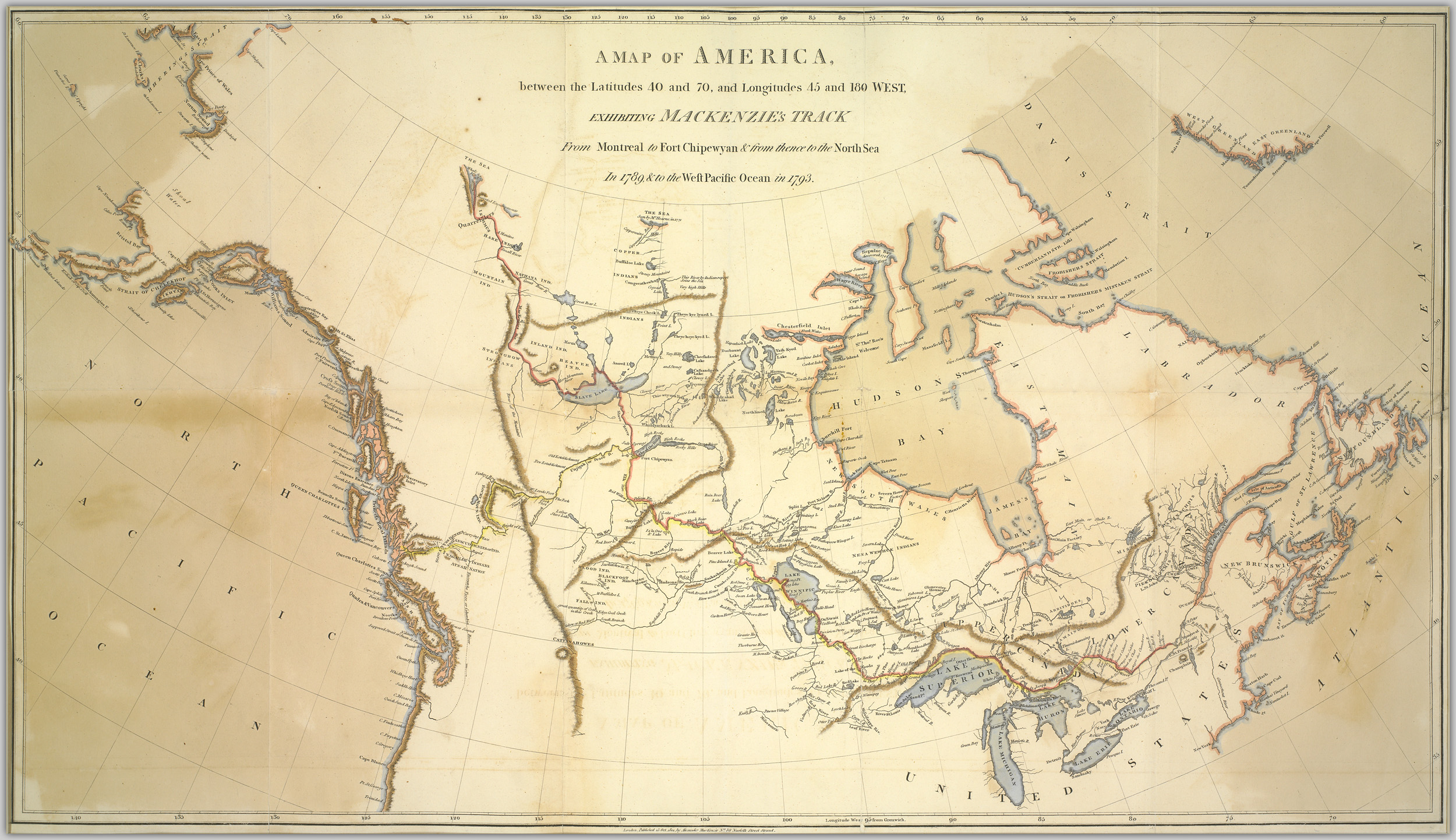
Image: A map of America, between the latitudes 40 and 70, and longitudes 45 and 180 West, exhibiting Mackenzie's track from Montreal to Fort Chipewyan and from thence to the North Sea in 1789, and to the (13407179855)
Description: No known copyright restrictions. Please credit UBC Library as the image source. For more information, see digitalcollections.library.ubc.ca/cdm/about. Creator: Mackenzie, Alexander, 1764-1820 Date Issued: 1801-10-13 Source: Original Format: University of British Columbia. Library. Rare Books and Special Collections. Andrew McCormick Maps and Prints. Permanent URL: digitalcollections.library.ubc.ca/cdm/singleitem/collecti...
Title: A map of America, between the latitudes 40 and 70, and longitudes 45 and 180 West, exhibiting Mackenzie's track from Montreal to Fort Chipewyan and from thence to the North Sea in 1789, and to the (13407179855)
Credit: https://www.flickr.com/photos/ubclibrary_digicentre/13407179855/
Author: UBC Library Digitization Centre
Permission: At the time of upload, the image license was automatically confirmed using the Flickr API. For more information see Flickr API detail.
Usage Terms: No known copyright restrictions
License: No restrictions
License Link: https://www.flickr.com/commons/usage/
Attribution Required?: No
Image usage
The following page links to this image:

.jpg)