
Image: AMH-8054-KB Map of Surinam
Size of this preview: 800 × 446 pixels. Other resolutions: 320 × 178 pixels | 2,400 × 1,337 pixels.
Original image (2,400 × 1,337 pixels, file size: 904 KB, MIME type: image/jpeg)
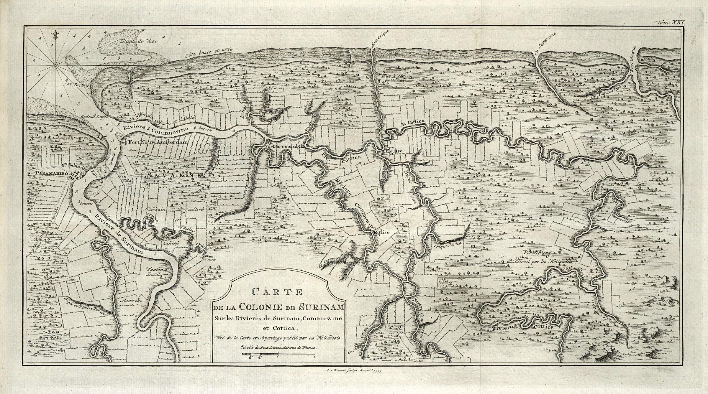
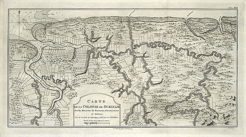
Description: Map of Surinam. Carte de la Colonie de Surinam / Sur les Rivieres de Surinam, Commewine et Cottica / Tiré de la Carte et Arpentage publié par les Hollandois. Top right: Tom. XXI. Cf. Rijksmuseum Amsterdam, inv. nrs. NG-539 and NG-478.
Title: Map of Surinam
Credit: This is an image from the Atlas of Mutual Heritage and the Koninklijke Bibliotheek, the Dutch National Library. The metadata of this file is public domain under a Creative Commons Public Domain Dedication (CC-ZERO). This permission has been archived as ticket #2014051410008887
Author: Evert van Harrevelt
Usage Terms: Public domain
License: Public domain
Attribution Required?: No
Image usage
The following page links to this image:

All content from Kiddle encyclopedia articles (including the article images and facts) can be freely used under Attribution-ShareAlike license, unless stated otherwise.