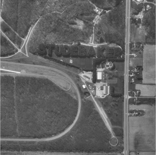
Image: 86.48851W 41.66850N Studabaker Trees

Description: USGS Digital Ortho Layer in NASA WorldWind software showing the Studebaker tree grove at Bendix Woods, Indiana, USA. Image rotated 90 degrees (north is to the right of the image). Height of 1.1km
Title: 86.48851W 41.66850N Studabaker Trees
Credit: Created with NASA WorldWind by User:Oaktree_b using USGS Digital Ortho Layer
Author: USGS
Permission: Public domainPublic domainfalsefalse This image is in the public domain because it is a screenshot from NASA’s globe software World Wind using a public domain layer, such as Blue Marble, MODIS, Landsat, SRTM, USGS or GLOBE. العربيَّة | English | فارسی | français | עברית | македонски | മലയാളം | Nederlands | русский | 中文(中国大陆) | +/−
Usage Terms: Public domain
License: Public domain
Attribution Required?: No
Image usage
The following page links to this image:

