
Image: 3 -Murad I map
Size of this preview: 753 × 599 pixels. Other resolutions: 302 × 240 pixels | 892 × 710 pixels.
Original image (892 × 710 pixels, file size: 59 KB, MIME type: image/png)
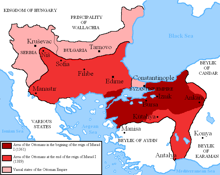
Description: Map showing the area of the Ottoman Empire during the reign of Murad I and his conquests. I used the information of various historical books and these maps: [1] [2]
Title: 3 -Murad I map
Credit: Own work
Author: DragonTiger23
Usage Terms: Creative Commons Attribution-Share Alike 3.0
License: CC BY-SA 3.0
License Link: https://creativecommons.org/licenses/by-sa/3.0
Attribution Required?: Yes
Image usage
The following page links to this image:

All content from Kiddle encyclopedia articles (including the article images and facts) can be freely used under Attribution-ShareAlike license, unless stated otherwise.