
Image: 2019 Cotabato EQs+faults
Size of this preview: 562 × 599 pixels. Other resolutions: 225 × 240 pixels | 2,452 × 2,615 pixels.
Original image (2,452 × 2,615 pixels, file size: 4.41 MB, MIME type: image/png)
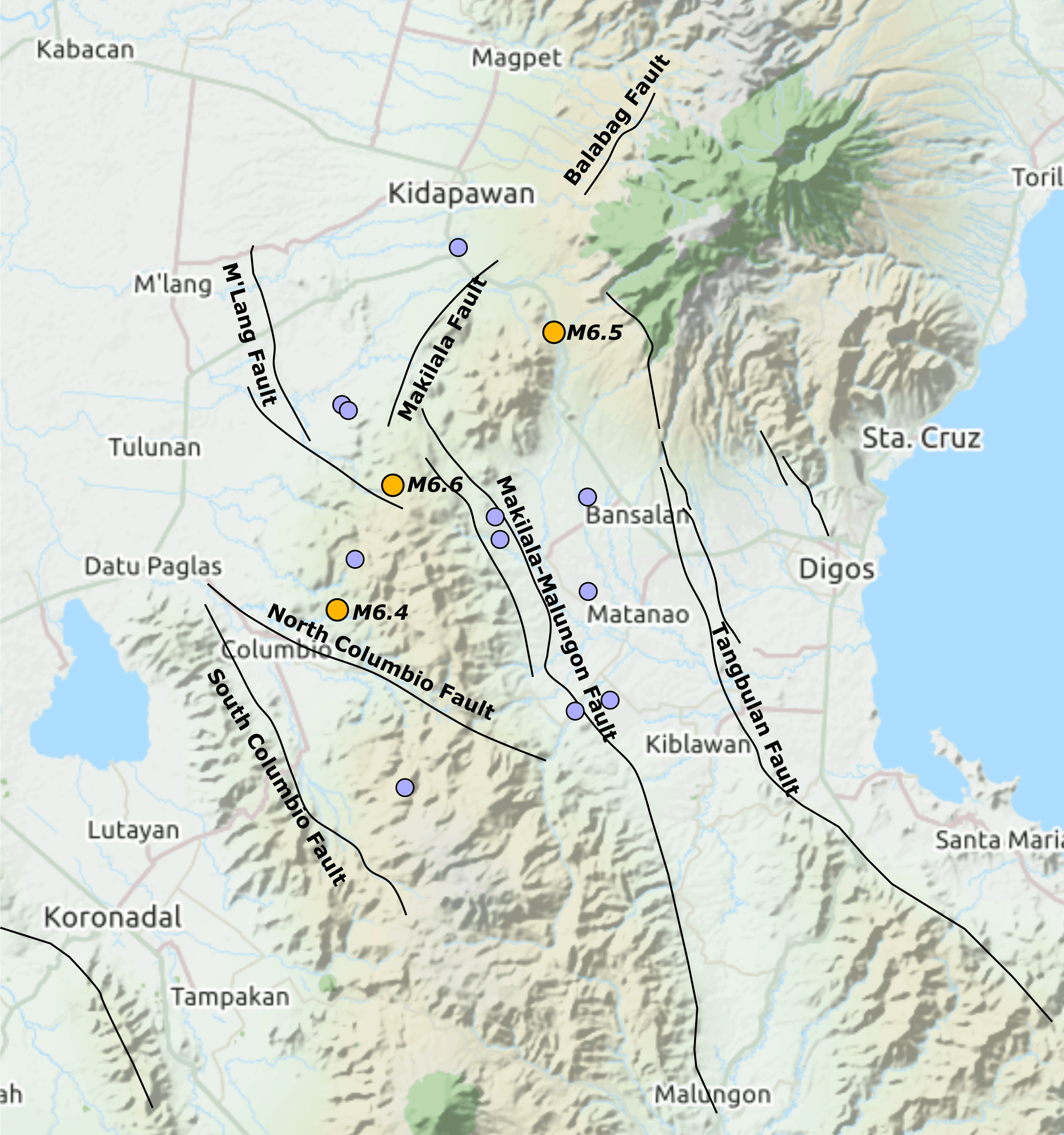
Description: Map showing the epicentres of all earthquakes of magnitude M≥5 in the October 2019 sequence, locations from USGS, with main active faults from PHIVOLCS on a base from Open Street Map, tiles courtesy of Andy Allan
Title: 2019 Cotabato EQs+faults
Credit: Own work
Author: Mikenorton
Usage Terms: Creative Commons Attribution-Share Alike 4.0
License: CC BY-SA 4.0
License Link: https://creativecommons.org/licenses/by-sa/4.0
Attribution Required?: Yes
Image usage
The following page links to this image:

All content from Kiddle encyclopedia articles (including the article images and facts) can be freely used under Attribution-ShareAlike license, unless stated otherwise.