
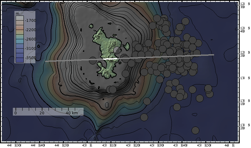
Image: 2019-03-08-Mayotte-Bathymetry-EQs-Section
Description: Combination of ground level contours, water depth (bathymetry) contours (both at 250m intervals), earthquake epicentres from 2018 to plot date (in file name), and a colourisation of the contours. The line of the associated section is indicated. Prepared using data from ISC (eqs) and GMRT (depths/ heights) and the tool GeoMapApp http://www.geomapapp.org/ . Prepared by uploader and placed into public domain at this time. Intended for use in reporting of 2018-2019 earthquake swarm on Mayotte island.
Title: 2019-03-08-Mayotte-Bathymetry-EQs-Section
Credit: Prepared from public databases, using tool http://www.geomapapp.org/.
Author: Aidan Karley
Usage Terms: Public domain
License: Public domain
Attribution Required?: No
Image usage
The following page links to this image:
