
Image: 2018-Waterschap-prov-1200

Size of this preview: 466 × 600 pixels. Other resolutions: 186 × 240 pixels | 1,200 × 1,545 pixels.
Original image (1,200 × 1,545 pixels, file size: 286 KB, MIME type: image/png)
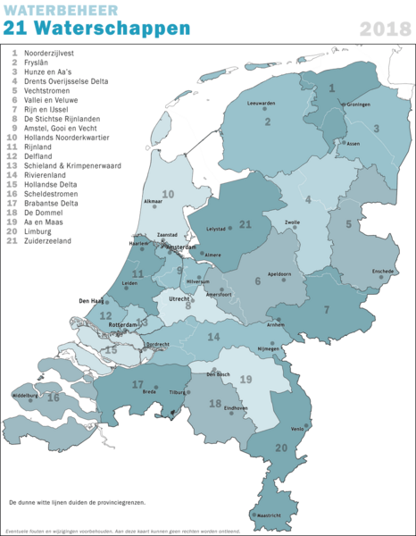
Description: Overview map of the 21 Dutch Polder Boards ("Waterschappen") as of 2018, including the provincial borders.
Title: 2018-Waterschap-prov-1200
Credit: Own work
Author: Janwillemvanaalst
Usage Terms: Creative Commons Attribution-Share Alike 4.0
License: CC BY-SA 4.0
License Link: https://creativecommons.org/licenses/by-sa/4.0
Attribution Required?: Yes
Image usage
The following page links to this image:

All content from Kiddle encyclopedia articles (including the article images and facts) can be freely used under Attribution-ShareAlike license, unless stated otherwise.