
Image: 2013-Top33-P08-Zuid-Holland

Size of this preview: 704 × 599 pixels. Other resolutions: 282 × 240 pixels | 11,205 × 9,538 pixels.
Original image (11,205 × 9,538 pixels, file size: 60.67 MB, MIME type: image/jpeg)
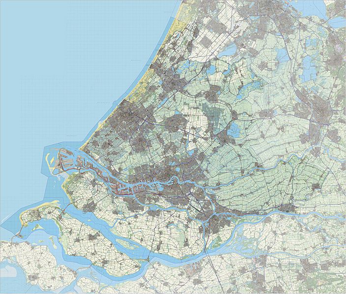
Description: Topografische kaart van de provincie Zuid-Holland (2013). Op basis van de GML open geodata van de BRT/Top10NL (basisregistratie Topografie, Kadaster 2011), vrijgegeven door Kadaster onder de Creative Commons BY licentie. Additionele gegevens uit BAG en uit de Risicokaart. Samenstelling en kleurenschema: Jan-Willem van Aalst, met QuantumGIS en Photoshop. Zie ook de Legenda.
Title: 2013-Top33-P08-Zuid-Holland
Credit: Own work
Author: Janwillemvanaalst
Usage Terms: Creative Commons Attribution-Share Alike 3.0
License: CC BY-SA 3.0
License Link: http://creativecommons.org/licenses/by-sa/3.0
Attribution Required?: Yes
Image usage
The following page links to this image:

All content from Kiddle encyclopedia articles (including the article images and facts) can be freely used under Attribution-ShareAlike license, unless stated otherwise.