
Image: 2008-06-14 NOAA flooding overview
No higher resolution available.
2008-06-14_NOAA_flooding_overview.png (531 × 371 pixels, file size: 37 KB, MIME type: image/png)
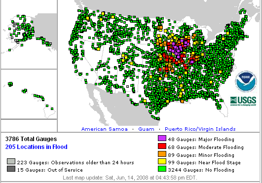
Description: A map showing all observed locations for water level in the United States on June 14, 2008 during historic flooding in the Midwest. Yellow is near flood stage, orange is minor flooding, red moderate flooding and purple major flooding. Green denotes no flooding.
Title: 2008-06-14 NOAA flooding overview
Credit: National Oceanic and Atmospheric Administration (NOAA) Original image
Author: National Oceanic and Atmospheric Administration (NOAA)
Permission: See license; Public domain
Usage Terms: Public domain
License: Public domain
Attribution Required?: No
Image usage
The following page links to this image:

All content from Kiddle encyclopedia articles (including the article images and facts) can be freely used under Attribution-ShareAlike license, unless stated otherwise.