
Image: 1 map of Pleistocene lakes in the Great Basin
Size of this preview: 514 × 600 pixels. Other resolutions: 206 × 240 pixels | 3,600 × 4,200 pixels.
Original image (3,600 × 4,200 pixels, file size: 929 KB, MIME type: image/png)
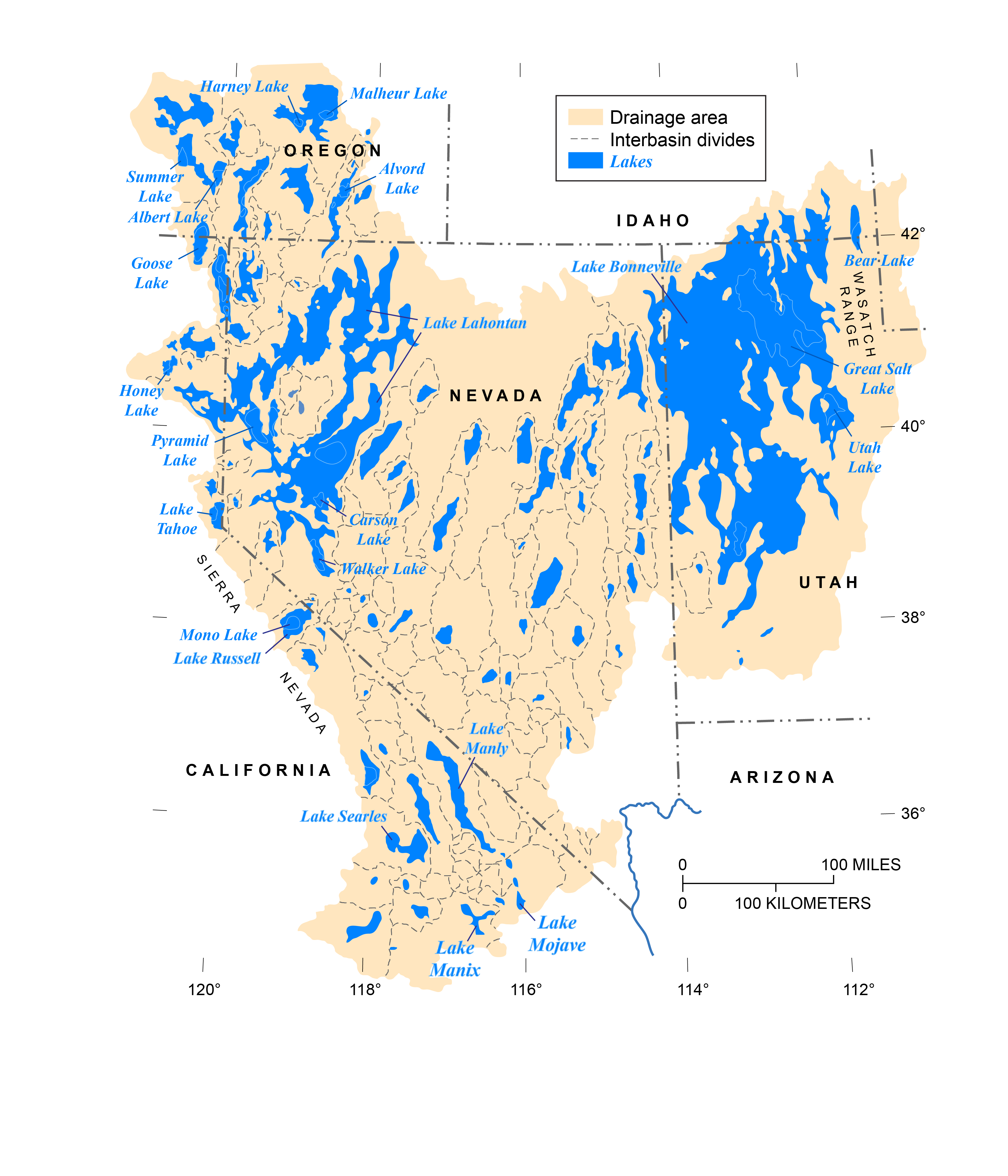
Description: Map of Pleistocene lakes in the Great Basin of western North America
Title: 1 map of Pleistocene lakes in the Great Basin
Credit: [drawn by J. Havens, U.S. Geological Survey, modified from figure 2 of Morrison, 1991 (Geological Society of America, Volume K-2, Quaternary Nonglacial Geology: Conterminous U.S.); first released by Reheis, M.C., and Bright, J., in 2009 on a now-defunct U.S.G.S. website; further modified by J. Havens in 2019].
Author: J. Havens
Usage Terms: Creative Commons Attribution-Share Alike 4.0
License: CC BY-SA 4.0
License Link: https://creativecommons.org/licenses/by-sa/4.0
Attribution Required?: Yes
Image usage
The following page links to this image:

All content from Kiddle encyclopedia articles (including the article images and facts) can be freely used under Attribution-ShareAlike license, unless stated otherwise.