
Image: 19th Kum River Map2
Size of this preview: 768 × 600 pixels. Other resolutions: 308 × 240 pixels | 1,500 × 1,171 pixels.
Original image (1,500 × 1,171 pixels, file size: 506 KB, MIME type: image/jpeg)
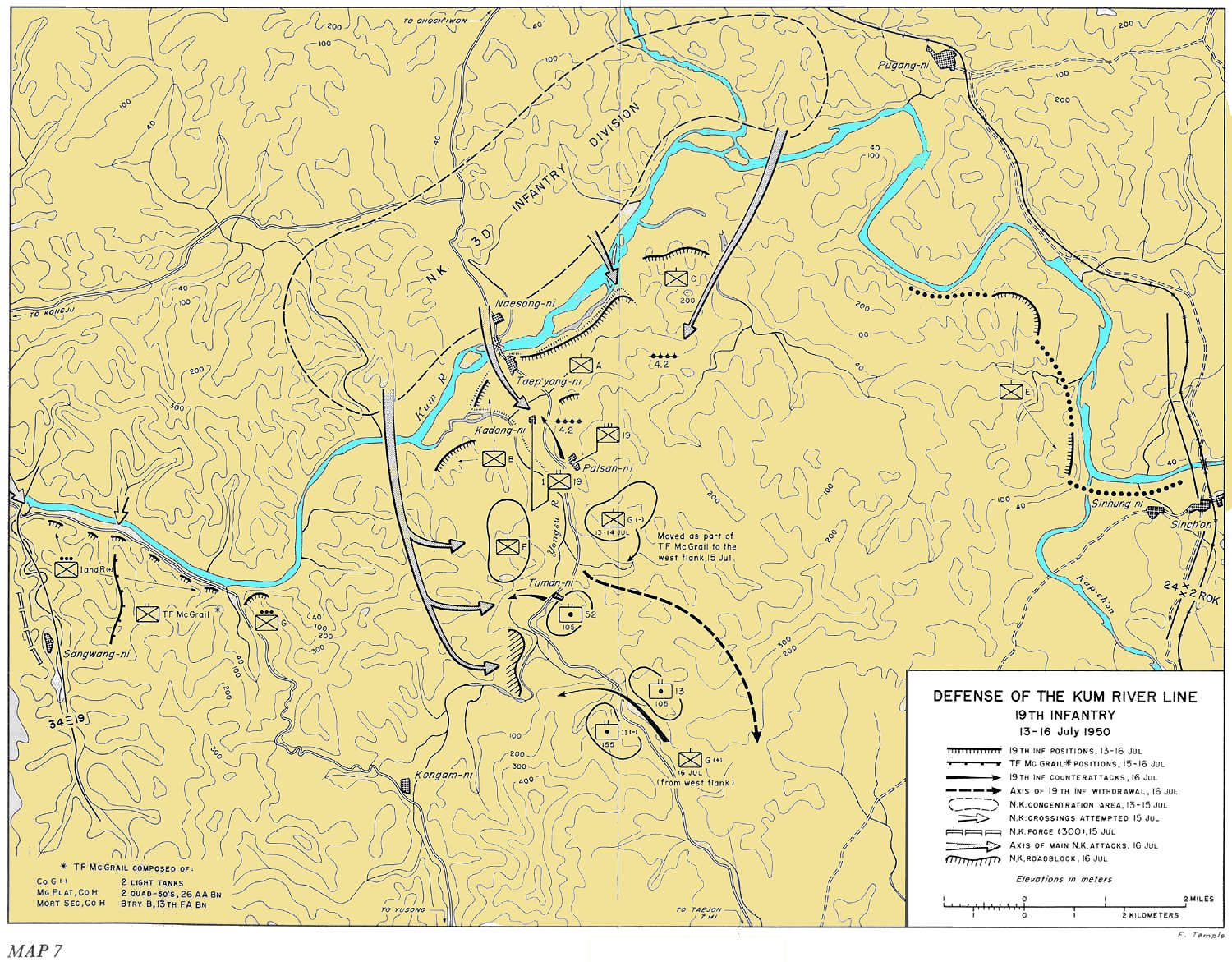
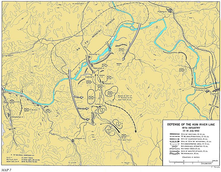
Description: Defense of the Kum River Line, 19th Infantry - 13-16 July 1950
Title: 19th Kum River Map2
Credit: http://www.koreanwar.org/html/korean_war_maps_results.html?map_url=SNK_MAP_7_1500W, map as originally published in South to the Naktong, North to the Yalu by Roy Appleman, US Army historian (1992)
Author: Center of Military History, United States Army
Usage Terms: Public domain
License: Public domain
Attribution Required?: No
Image usage
The following page links to this image:

All content from Kiddle encyclopedia articles (including the article images and facts) can be freely used under Attribution-ShareAlike license, unless stated otherwise.