
Image: 1951 RCC map

Size of this preview: 376 × 600 pixels. Other resolutions: 150 × 240 pixels | 1,080 × 1,722 pixels.
Original image (1,080 × 1,722 pixels, file size: 468 KB, MIME type: image/jpeg)
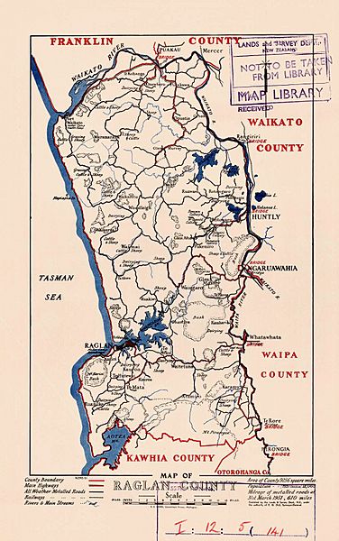
Description: 1951 Raglan County Council map
Title: 1951 RCC map
Credit: https://natlib.govt.nz/records/37099364
Author: Department of Lands and Survey cartographer - Sourced from LINZ. Crown Copyright reserved.
Usage Terms: Creative Commons Attribution-Share Alike 4.0
License: CC BY-SA 4.0
License Link: https://creativecommons.org/licenses/by-sa/4.0
Attribution Required?: Yes
Image usage
The following page links to this image:

All content from Kiddle encyclopedia articles (including the article images and facts) can be freely used under Attribution-ShareAlike license, unless stated otherwise.