
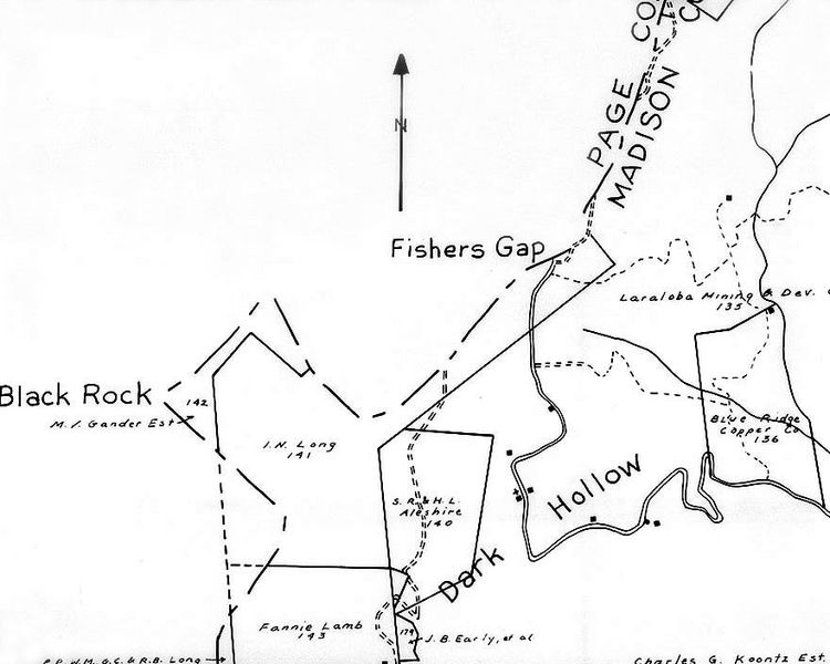
Image: 1932 U S Geological Survey of Shenandoah National Park, Madison Tract 141

Size of this preview: 750 × 600 pixels. Other resolutions: 300 × 240 pixels | 880 × 704 pixels.
Original image (880 × 704 pixels, file size: 103 KB, MIME type: image/jpeg)
Description: Detail of the 1932 U S Geological Survey of Shenandoah National Park, Madison Tract 141, that shows the properties acquired by the park in the 1930s near Fisher's Gap. Norman Forder sent me a photocopy of a very small portion of the 1932 U. S. Geological Survey of Shenandoah National Park centered around Fisher's Gap, which I scanned to make the .jpg file.
Title: 1932 U S Geological Survey of Shenandoah National Park, Madison Tract 141
Credit: Mr. Norman Forder, Facilities Services Assistant, Shenandoah National Park at Luray, Virginia
Author: 1932 U S Geological Survey of Shenandoah National Park
Usage Terms: Public domain
License: Public domain
Attribution Required?: No
Image usage
The following page links to this image:

All content from Kiddle encyclopedia articles (including the article images and facts) can be freely used under Attribution-ShareAlike license, unless stated otherwise.