
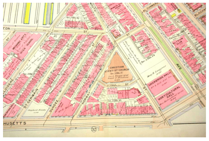
Image: 1908 ChickeringHall map Boston byBromley
No higher resolution available.
1908_ChickeringHall_map_Boston_byBromley.png (689 × 465 pixels, file size: 221 KB, MIME type: image/png)
Description: Detail of map of Boston, Massachusetts, in 1908, showing Chickering Hall, Horticultural Hall, etc.
Title: 1908 ChickeringHall map Boston byBromley
Credit: Bromley, George W. Atlas of the City of Boston. Philadelphia: 1908. / City of Boston, Boston Landmarks Commission. Christian Science Center Complex: Boston Landmarks Commission Study Report. As amended January 25, 2011
Author: Bromley
Usage Terms: Public domain
License: Public domain
Attribution Required?: No
Image usage
The following 2 pages link to this image:

All content from Kiddle encyclopedia articles (including the article images and facts) can be freely used under Attribution-ShareAlike license, unless stated otherwise.