
Image: 1907BurkeIdaho geologic map

Size of this preview: 800 × 395 pixels. Other resolutions: 320 × 158 pixels | 1,819 × 898 pixels.
Original image (1,819 × 898 pixels, file size: 1.46 MB, MIME type: image/png)
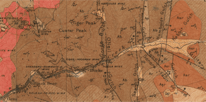
Description: 1907 Burke Idaho geologic map, where m is monzonite and syenite, Ap is Prichard Slate, Ab is Burke Formation, Ar is Revett Quartzite, Asr is St. Regis Formation, Aw is Wallace Formation, Asp is Striped Peak Formation, Tg are Tertiary terrace gravels, Qgl is Quaternary glacial deposits, Qal is Quaternary alluvium, x is a prospect pit and y is a tunnel
Title: 1907BurkeIdaho geologic map
Credit: The geology and ore deposits of the Coeur d'Alene district, Idaho, USGS Professional Paper 62, https://pubs.er.usgs.gov/publication/pp62
Author: U.S. Dept. of the Interior, USGS, F. L. Ransome and Frank Cathcart Calkins
Usage Terms: Public domain
License: Public domain
Attribution Required?: No
Image usage
The following page links to this image:

All content from Kiddle encyclopedia articles (including the article images and facts) can be freely used under Attribution-ShareAlike license, unless stated otherwise.