
Image: 1898 Niger map byJohnston BPL m0612007
Size of this preview: 436 × 599 pixels. Other resolutions: 174 × 240 pixels | 545 × 749 pixels.
Original image (545 × 749 pixels, file size: 301 KB, MIME type: image/png)
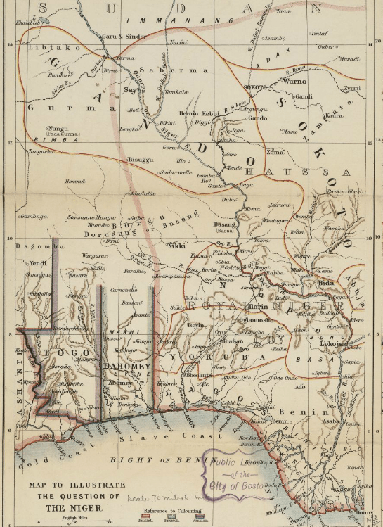
Description: "Map to Illustrate the Question of the Niger" (1:4,435,200). Detail of: Maps to Illustrate the Niger and Upper Nile Questions Author: W. & A. K. Johnston Publisher: Johnston, W. & A. K. Date: 1898 Location: Africa, Africa, North, Africa, West, Darfur (Sudan), Niger River, Nigeria, Nile River, Sudan Dimension: 51.0 x 44.0 cm. Call Number: G8201.P53 1898 .J65
Title: 1898 Niger map byJohnston BPL m0612007
Credit: Boston Public Library / http://maps.bpl.org/id/m0612007
Author: Johnston
Usage Terms: Public domain
License: Public domain
Attribution Required?: No
Image usage
The following page links to this image:

All content from Kiddle encyclopedia articles (including the article images and facts) can be freely used under Attribution-ShareAlike license, unless stated otherwise.