
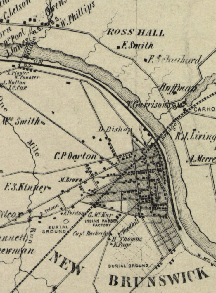
Image: 1850 Map of Middlesex County, NJ - Ross Hall detail
Size of this preview: 442 × 600 pixels. Other resolutions: 177 × 240 pixels | 739 × 1,003 pixels.
Original image (739 × 1,003 pixels, file size: 638 KB, MIME type: image/png)
Description: Detail showing Ross Hall and local area, including New Brunswick
Title: Map of Middlesex County, New Jersey - Ross Hall detail
Credit: This map is available from the United States Library of Congress's Geography & Map Division under the digital ID g3813m.la000456. This tag does not indicate the copyright status of the attached work. A normal copyright tag is still required. See Commons:Licensing for more information.
Author: J. W. Otley
Usage Terms: Public domain
License: Public domain
Attribution Required?: No
Image usage
The following page links to this image:

All content from Kiddle encyclopedia articles (including the article images and facts) can be freely used under Attribution-ShareAlike license, unless stated otherwise.