
Image: 1829 Black Rock Harbour map
Size of this preview: 800 × 487 pixels. Other resolutions: 320 × 195 pixels | 3,662 × 2,227 pixels.
Original image (3,662 × 2,227 pixels, file size: 1.42 MB, MIME type: image/jpeg)
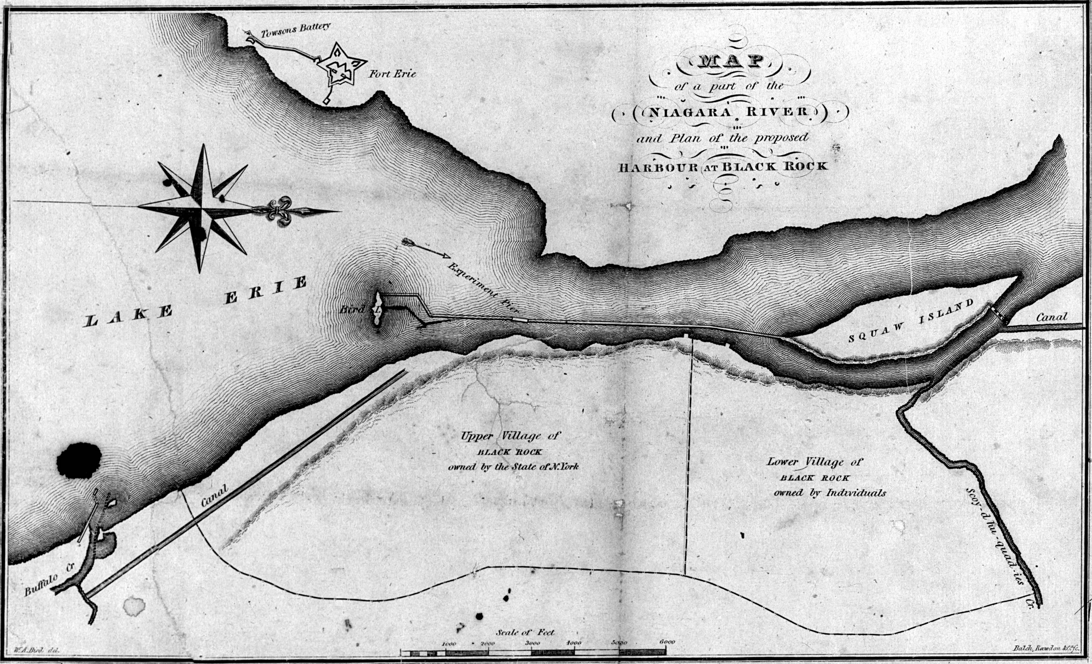
Description: "Map of a part of the Niagara River and plan of the proposed harbour at Black Rock." Also showing Squaw Island and Bird Island.
Title: 1829 Black Rock Harbour map
Credit: http://www.brocku.ca/maplibrary/digital/MAPzoom/MAPimages/WEBjpgs/NMC-059331.jpg
Author: W.A. Bird; Balch, Rawdon & Co.
Usage Terms: Public domain
License: Public domain
Attribution Required?: No
Image usage
The following page links to this image:

All content from Kiddle encyclopedia articles (including the article images and facts) can be freely used under Attribution-ShareAlike license, unless stated otherwise.