
Image: 1743 NorthEnd Boston map WilliamPrice
Size of this preview: 800 × 568 pixels. Other resolutions: 320 × 227 pixels | 810 × 575 pixels.
Original image (810 × 575 pixels, file size: 865 KB, MIME type: image/png)
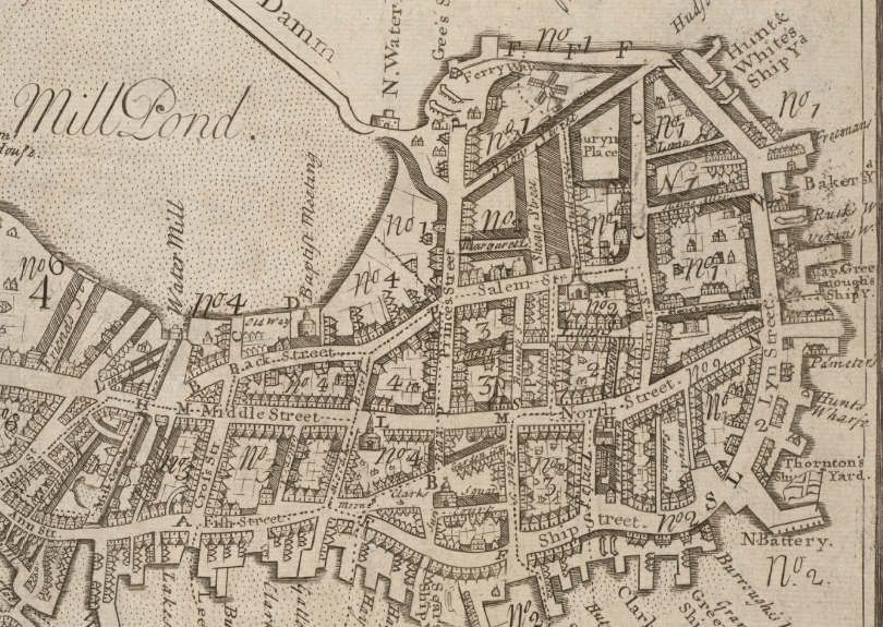
Description: Detail of 1743 map of Boston by William Price, showing the North End and vicinity.
Title: 1743 NorthEnd Boston map WilliamPrice
Credit: Boston Public Library / http://maps.bpl.org/details_10913
Author: William Price
Usage Terms: Public domain
License: Public domain
Attribution Required?: No
Image usage
The following 2 pages link to this image:

All content from Kiddle encyclopedia articles (including the article images and facts) can be freely used under Attribution-ShareAlike license, unless stated otherwise.