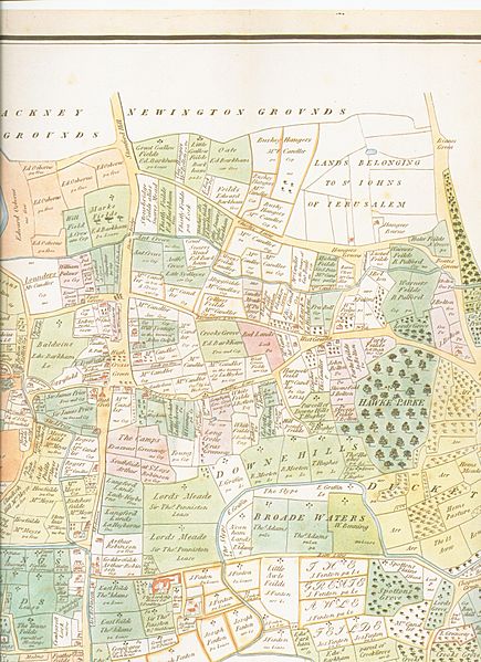
Image: 1619 Tottenham map (full)

Size of this preview: 435 × 599 pixels. Other resolutions: 174 × 240 pixels | 2,544 × 3,504 pixels.
Original image (2,544 × 3,504 pixels, file size: 1.3 MB, MIME type: image/jpeg)
Description: 1619 map of the Parish of Tottenham, Middlesex (now in the London Borough of Haringey)
Title: 1619 Tottenham map (full)
Credit: Tottenham Parish Plan 1619
Author: Thomas Clay[1]
Permission: This work is in the public domain in its country of origin and other countries and areas where the copyright term is the author's life plus 100 years or less. You must also include a United States public domain tag to indicate why this work is in the public domain in the United States. This file has been identified as being free of known restrictions under copyright law, including all related and neighboring rights.
Usage Terms: Public domain
License: Public domain
Attribution Required?: No
Image usage
The following page links to this image:

All content from Kiddle encyclopedia articles (including the article images and facts) can be freely used under Attribution-ShareAlike license, unless stated otherwise.
