Hukanui railway station facts for kids
Quick facts for kids
Hukanui railway station
|
|||||||||||
|---|---|---|---|---|---|---|---|---|---|---|---|

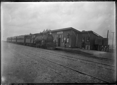
Hukanui about 1917
|
|||||||||||
| Location | New Zealand | ||||||||||
| Coordinates | 40°34′01″S 175°41′40″E / 40.566972°S 175.694450°E | ||||||||||
| Elevation | 195 m (640 ft) | ||||||||||
| Line(s) | Wairarapa Line | ||||||||||
| Distance | Wellington 137.28 km (85.30 mi) | ||||||||||
| History | |||||||||||
| Opened | 9 October 1896 | ||||||||||
| Closed | 1 August 1988 | ||||||||||
| Services | |||||||||||
|
|||||||||||
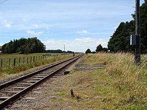
The Hukanui railway station on the Wairarapa Line was located in the Tararua District of the Manawatū-Whanganui region in New Zealand’s North Island.
The station served the settlement of Hukanui, which was established in 1894, and was briefly called Brownston. The New Zealand Ministry for Culture and Heritage gives a translation of "heavy snow" for Hukanui.
The station opened on 9 October 1896 and closed on 1 August 1988. It became a siding in January 2009.
The 162-metre (531 ft) bridge across Mangatainoka River, to the south of Hukanui, is the longest on the line.

All content from Kiddle encyclopedia articles (including the article images and facts) can be freely used under Attribution-ShareAlike license, unless stated otherwise. Cite this article:
Hukanui railway station Facts for Kids. Kiddle Encyclopedia.

