History of Solomon Islands facts for kids
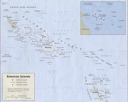
Solomon Islands is a sovereign state in the Melanesia subregion of Oceania in the western Pacific Ocean. This page is about the history of the nation state rather than the broader geographical area of the Solomon Islands archipelago, which covers both Solomon Islands and Bougainville Island, a province of Papua New Guinea. For the history of the archipelago not covered here refer to the former administration of the British Solomon Islands Protectorate, the North Solomon Islands and the History of Bougainville.
Contents
Earliest inhabitants in Solomon Islands
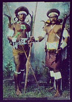
The human history of Solomon Islands begins with the first Papuan settlement at least 30,000 years ago from New Guinea. They represented the furthest expansion of humans into the Pacific until the expansion of Austronesian-language speakers through the area around 4000 BC, bringing new agricultural and maritime technology. Most of the languages spoken today in Solomon Islands derive from this era, but some thirty languages of the pre-Austronesian settlers survive. Most of the people that settled there back then were Papuans (see East Papuan languages).
There are preserved numerous pre-European cultural monuments in Solomon Islands, notably Bao megalithic shrine complex (13th century AD), Nusa Roviana fortress and shrines (14th – 19th century), Vonavona Skull island – all in Western province. Nusa Roviana fortress, shrines and surrounding villages served as a hub of regional trade networks in 17th – 19th centuries. Skull shrines of Nusa Roviana are sites of legends. Better known is Tiola shrine – site of legendary stone dog which turned towards the direction where enemy of Roviana was coming from. This complex of archaeological monuments characterises fast development of local Roviana culture, through trade and head hunting expeditions turning into regional power in 17th – 18th centuries.
European contact
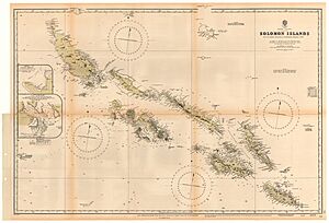
Ships of the Spanish explorer Álvaro de Mendaña de Neira first sighted Santa Isabel island on 7 February 1568. Finding signs of alluvial gold on Guadalcanal, Mendaña believed he had found the source of King Solomon's wealth, and consequently named the islands "The Islands of Solomon".
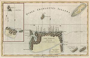
In 1595 and 1605 Spain again sent several expeditions to find the islands and establish a colony; however these were unsuccessful. In 1767, Commander Philip Carteret of HMS Swallow rediscovered the Santa Cruz Islands and Malaita. Later, Dutch, French and British navigators visited the islands; their reception was often hostile.
Christian missionaries began visiting the Solomons from the 1840s, beginning with an attempt by French Catholics under Jean-Baptiste Epalle to establish a mission on Santa Isabel Island, which was abandoned after Epalle was killed by islanders in 1845. Anglican missionaries began arriving from the 1850s, followed by other denominations, over time gaining a large number of converts.
Museums with significant collections of Solomon Islands artifacts include the Bishop Museum, the Peabody Museum of Salem, South Sea Islands Museum and National Museum of Ireland.
Colonisation
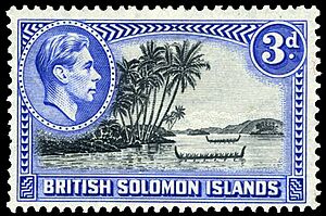
Sikaiana, then known as the Stewart Islands, was annexed to the Hawaiian Kingdom in 1856. Hawai'i did not formalize the annexation, and the United States refused to recognize Hawaiian sovereignty over Sikaiana when the United States annexed Hawai'i in 1898.
The colonial ambitions of Imperial Germany led to the establishment of a German Protectorate over the North Solomon Islands, which covered parts of what is now Solomon Islands, following the Anglo-German Declarations about the Western Pacific Ocean (1886), which established "spheres of influence" that Germany and the United Kingdom agreed, with Germany giving up its claim to the southern Solomon Islands.
In June 1893, Captain Herbert Gibson of HMS Curacoa, declared the southern Solomon Islands a British protectorate.
No immediate steps to place administrators in the Solomon Islands, which were made part of the British Western Pacific Territories (BWPT), which was administered by a high commissioner who resided in Fiji. The Colonial Office appointed Charles Morris Woodford as the Resident Commissioner in the Solomon Islands on 17 February 1897. He was directed to control the labour trade operating in the Solomon Island waters and to stop the illegal trade in firearms. Arthur Mahaffy was appointed as the Deputy Commissioner to Woodford in January 1898. In January 1900, Mahaffy established a government station at Gizo, as Woodford considered Mahaffy’s military training as making him suitable for the role of suppressing headhunting in New Georgia and neighbouring islands.
In 1898 Britain annexed the Santa Cruz and the Rennell and Bellona Islands. In 1900, under the terms of the Treaty of Berlin (14 November 1899), Germany transferred Choiseul, Santa Isabel, the Shortlands and Ontong Java Atoll Islands to the British Solomon Islands Protectorate, but retained Bougainville and its surrounding islands. Germany granted this claim in exchange for the British giving up all claims to Western Samoa.
In 1927 District Commissioner William R. Bell was killed on Malaita, along with a cadet named Lillies and 13 Solomon Islanders in his charge. A massive punitive expedition, known as the Malaita massacre, ensued; at least 60 Kwaio were killed, nearly 200 detained in Tulagi (the protectorate capital), and many sacred sites and objects were destroyed or desecrated.
World War II
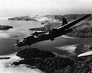
Japanese forces occupied the North Solomon Islands, part of the Australian Territory of New Guinea, in January 1942, going South to Tulagi. The counter-attack was led by the United States; the 1st Division of the US Marine Corps landed on Guadalcanal and Tulagi in August 1942. Some of the most bitter fighting of World War II took place on the islands for almost three years.
Tulagi, the seat of the British administration on the island of Nggela Sule in Central Province was destroyed in the heavy fighting following landings by the US Marines. Then the tough battle for Guadalcanal, which was centred on the capture of the airfield, Henderson field, led to the development of the adjacent town of Honiara as the United States logistics centre.
Biuku Gasa and Eroni Kumana
Islanders Biuku Gasa (deceased 2005) and Eroni Kumana (Gizo) (deceased 2014) were indigenous Allied scouts during the war. They became famous when they were noted by National Geographic for being the first men to find the shipwrecked John F. Kennedy and his crew of the PT-109 using a traditional dugout canoe. They suggested the idea of using a coconut which was later kept on the desk of the president to write a rescue message for delivery. Their names had not been credited in most movie and historical accounts, and they were turned back before they could visit President Kennedy's inauguration, though the Australian coastwatcher would also meet the president.
Gasa and Kumana were interviewed by National Geographic in 2002, and can be seen on the DVD of the television special. They were presented a bust by Max Kennedy, a son of Robert F. Kennedy. The National Geographic had gone there as part of an expedition by Robert Ballard, who found the remains of the PT-109. The special was called The Search for Kennedy's PT 109.
Ambassador Caroline Kennedy met John Koloni, the son of Kumana, and Nelma Ane, daughter of Gasa at a ceremony in August 2023 in Honiara to mark the 80th anniversary of the battle of Guadalcanal. She also visited the places that her father had swum after the sinking of PT 109.
War consequences
The impact of the war on islanders was profound. The destruction caused by the fighting and the longer-term consequences of the introduction of modern materials, machinery and western cultural artefacts, transformed traditional isolated island ways of life. The reconstruction was slow in the absence of war reparations and with the destruction of the pre-war plantations, formerly the mainstay of the economy. Significantly, Solomon Islanders' experience as labourers with the Allies led some to a new appreciation of the importance of economic organisation and trade as the basis for material advancement. Some of these ideas were put into practice in the early post-war political movement "Maasina Ruru" – often corrupted to "Marching Rule".
Post war (1945–1978)
In 1956 a movement for social economic and political improvement using co-operatives economic enterprises in combination with a regard for custom and tradition to synthesise a new social order called Moro Movement began on Guadalcanal.
Stability was restored during the 1950s, as the British colonial administration built a network of official local councils. On this platform Solomon Islanders with experience on the local councils started participation in central government, initially through the bureaucracy and then, from 1960, through the newly established Legislative and Executive Councils. Positions on both Councils were initially appointed by the High Commissioner of the British Protectorate but progressively more of the positions were directly elected or appointed by electoral colleges formed by the local councils. The first national election was held in 1964 for the seat of Honiara, and by 1967 the first general election was held for all but one of the 15 representative seats on the Legislative Council (the one exception was the seat for the Eastern Outer Islands, which was again appointed by electoral college).
Elections were held again in 1970 and a new constitution was introduced. The 1970 constitution replaced the Legislative and Executive Councils with a single Governing Council. It also established a 'committee system of government' where all members of the Council sat on one or more of five committees. The aim of this system was to reduce divisions between elected representatives and the colonial bureaucracy, provide opportunities for training new representatives in managing the responsibilities of government.
It was also claimed that this system was more consistent with the Melanesian style of government. However this was quickly undermined by opposition to the 1970 constitution and the committee system by elected members of the council. As a result, a new constitution was introduced in 1974 which established a standard Westminster form of government and gave the Islanders both Chief Ministerial and Cabinet responsibilities. Solomon Mamaloni became the country's first Chief Minister in July 1974.
Independence (1978 - present)
As late as 1970, the British Protectorate did not envisage independence for Solomon Islands in the foreseeable future. Shortly thereafter, the financial costs of supporting the Protectorate became more trying, as the world economy was hit by the first oil price shock of 1973. The imminent independence of Papua New Guinea (in 1975) was also thought to have influenced the Protectorate's administrators.
Outside of a very small educated elite in Honiara, there was little in the way of an indigenous independence movement in the Solomons. Self-government was granted in January 1976 and after July 1976, Sir Peter Kenilorea became the Chief Minister who would lead the country to independence. Independence was granted on 7 July 1978, and Kenilorea automatically became the country's first Prime Minister.
The government continues to face serious problems, including an uncertain economic outlook, deforestation, and malaria control. At one point, prior to the deployment of RAMSI forces, the country was facing a serious financial crisis. While economic conditions are improving, the situation remains unstable.
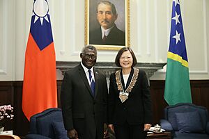
In May 2024, Jeremiah Manel was elected as the Solomon Islands new prime minister to succeed Manasseh Sogavare.
Cyclones
In 1992, Cyclone Tia struck the island of Tikopia, wiping out most housing and food crops. In 1997, the Government asked for help from the US and Japan to clean up more than 50 sunken World War II shipwrecks polluting coral reefs and killing marine life.
In December 2002, Severe Tropical Cyclone Zoe struck the island of Tikopia and Anuta, cutting off contact with the 3,000 inhabitants. Due to funding problems, the Solomon Islands government could not send relief until the Australian government provided funding.
Cyclone Ita
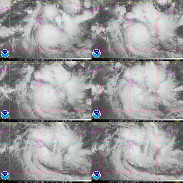
In April 2014 the islands were struck by the tropical low that later became Cyclone Ita. Throughout the Solomons, at least 23 people were killed while up to 40 others remained unaccounted for as of 6 April. An estimated 49,000 people were affected by the floods, of whom 9,000 were left homeless.
As the precursor tropical low to Ita affected the Islands, local authorities issued heavy flood warnings, tropical disturbance and cyclone watches. Nearly two days of continuous heavy rains from the storm caused flash flooding in the Islands. Over a four-day span, more than 1,000 mm (39 in) fell at the Gold Ridge mine in Guadalcanal, with 500 mm (20 in) falling in a 24‑hour span. The Matanikau River, which runs through the capital city Honiara, broke its banks on 3 April and devastated nearby communities. Thousands of homes along with the city's two main bridges were washed away, stranding numerous residents. The national hospital had to evacuate 500 patients to other facilities due to flooding. Graham Kenna from Save the Children stated that, "the scale of destruction is like something never seen before in the Solomon Islands." According to Permanent Secretary Melchoir Mataki, the majority of homes destroyed in Honiara were built on a flood plain where construction was not allowed.
Severe flooding took place on Guadalcanal. Immediately following the floods, Honiara and Guadalcanal were declared disaster areas by the Solomon Government. Debris left behind by the floods initially hampered relief efforts, with the runway at Honiara International Airport blocked by two destroyed homes. Food supplies started running low as the Red Cross provided aid to the thousands homeless. The airport was reopened on 6 April, allowing for supplies from Australia and New Zealand to be delivered. Roughly 20 percent of Honiara's population relocated to evacuation centers as entire communities were swept away. There were fears that the flooding could worsen an already ongoing dengue fever outbreak and cause outbreaks of diarrhea and conjunctivitis.
New Zealand offered an immediate NZ$300,000 in funds and deployed a C-130 Hercules with supplies and emergency response personnel. Australia donated A$250,000 on 6 April and sent engineers and response teams to aid in relief efforts. On 8 April, Australia increased its aid package to A$3 million while New Zealand provided an additional NZ$1.2 million. Taiwan provided US$200,000 in funds.
See also
 In Spanish: Historia de las Islas Salomón para niños
- History of Oceania
- Politics of Solomon Islands
- Prime Minister of Solomon Islands


