Hightstown, New Jersey facts for kids
Quick facts for kids
Hightstown, New Jersey
|
||
|---|---|---|
|
Borough
|
||

Samuel Sloan House on South Main Street
|
||
|
||

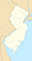
Location of Hightstown in Mercer County highlighted in red (right). Inset map: Location of Mercer County in New Jersey highlighted in orange (left).
<mapframe text="Interactive map of Hightstown, New Jersey" zoom="8" width="250" height="250"> { "type": "ExternalData", "service": "geoshape", "ids": "Q385746" } </mapframe> |
||

Census Bureau map of Hightstown, New Jersey
|
||
| Country | ||
| State | ||
| County | Mercer | |
| Incorporated | March 5, 1853 | |
| Named for | Hight family | |
| Government | ||
| • Type | Borough | |
| • Body | Borough Council | |
| Area | ||
| • Total | 1.27 sq mi (3.28 km2) | |
| • Land | 1.23 sq mi (3.19 km2) | |
| • Water | 0.03 sq mi (0.09 km2) 2.60% | |
| Area rank | 478th of 565 in state 10th of 12 in county |
|
| Elevation | 92 ft (28 m) | |
| Population
(2020)
|
||
| • Total | 5,900 | |
| • Estimate
(2023)
|
5,853 | |
| • Rank | 352nd of 565 in state 10th of 12 in county |
|
| • Density | 4,785.1/sq mi (1,847.5/km2) | |
| • Density rank | 119th of 565 in state 2nd of 12 in county |
|
| Time zone | UTC−05:00 (Eastern (EST)) | |
| • Summer (DST) | UTC−04:00 (Eastern (EDT)) | |
| ZIP Code |
08520
|
|
| Area code(s) | 609 | |
| FIPS code | 3402131620 | |
| GNIS feature ID | 0885254 | |
| Website | ||
Hightstown is a borough in Mercer County, in the U.S. state of New Jersey. Nestled within the Raritan Valley region, Hightstown is an historic, commercial, and cultural hub of Central New Jersey, along with being a diverse outer-ring commuter suburb of New York City in the New York Metropolitan Area. As of the 2020 United States census, the borough's population was 5,900, its highest decennial count ever and an increase of 406 (+7.4%) from the 5,494 recorded at the 2010 census, which in turn reflected an increase of 278 (+5.3%) from the 5,216 counted in the 2000 census.
Hightstown was incorporated as a borough by an act of the New Jersey Legislature on March 5, 1853, within portions of East Windsor Township. The borough became fully independent around 1894. Additional portions of East Windsor Township were annexed in 1913, 1915, and 1927. The traditional explanation is that the borough was named for John and Mary Hight, who established a tavern in the area in the 1750s.
Contents
Geography
According to the United States Census Bureau, the borough had a total area of 1.27 square miles (3.28 km2), including 1.23 square miles (3.19 km2) of land and 0.03 square miles (0.09 km2) of water (2.60%).
The borough is an independent municipality surrounded entirely by East Windsor, making it part one of 21 pairs of "doughnut towns" in the state, where one municipality entirely surrounds another.
Hightstown is at the central-most point of New Jersey and is roughly equidistant from Philadelphia and New York City.
Demographics
| Historical population | |||
|---|---|---|---|
| Census | Pop. | %± | |
| 1860 | 970 | — | |
| 1870 | 1,347 | 38.9% | |
| 1880 | 1,355 | 0.6% | |
| 1890 | 1,875 | 38.4% | |
| 1900 | 1,749 | −6.7% | |
| 1910 | 1,879 | 7.4% | |
| 1920 | 2,674 | 42.3% | |
| 1930 | 3,012 | 12.6% | |
| 1940 | 3,486 | 15.7% | |
| 1950 | 3,712 | 6.5% | |
| 1960 | 4,317 | 16.3% | |
| 1970 | 5,431 | 25.8% | |
| 1980 | 4,581 | −15.7% | |
| 1990 | 5,126 | 11.9% | |
| 2000 | 5,216 | 1.8% | |
| 2010 | 5,494 | 5.3% | |
| 2020 | 5,900 | 7.4% | |
| 2023 (est.) | 5,853 | 6.5% | |
| Population sources:1860–1920 1870 1880–1890 1890–1910 1910–1930 1940–2000 2000 2010 2020 |
|||
2010 census
The 2010 United States census counted 5,494 people, 1,976 households, and 1,352 families in the borough. The population density was 4,536.0 per square mile (1,751.4/km2). There were 2,108 housing units at an average density of 1,740.4 per square mile (672.0/km2). The racial makeup was 69.44% (3,815) White, 8.05% (442) Black or African American, 0.56% (31) Native American, 4.08% (224) Asian, 0.15% (8) Pacific Islander, 13.56% (745) from other races, and 4.17% (229) from two or more races. Hispanic or Latino of any race were 30.29% (1,664) of the population.
Of the 1,976 households, 32.0% had children under the age of 18; 51.2% were married couples living together; 11.2% had a female householder with no husband present and 31.6% were non-families. Of all households, 24.6% were made up of individuals and 6.7% had someone living alone who was 65 years of age or older. The average household size was 2.73 and the average family size was 3.23.
23.9% of the population were under the age of 18, 8.6% from 18 to 24, 31.1% from 25 to 44, 26.7% from 45 to 64, and 9.6% who were 65 years of age or older. The median age was 36.9 years. For every 100 females, the population had 99.5 males. For every 100 females ages 18 and older there were 100.1 males.
The Census Bureau's 2006–2010 American Community Survey showed that (in 2010 inflation-adjusted dollars) median household income was $66,250 (with a margin of error of ± $8,281) and the median family income was $72,583 (± $13,355). Males had a median income of $49,861 (± $9,561) versus $42,361 (± $14,837) for females. The per capita income for the borough was $32,976 (± $3,402). About 8.2% of families and 8.7% of the population were below the poverty line, including 17.2% of those under age 18 and 1.1% of those age 65 or over.
Economy
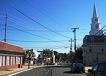
Downtown Hightstown, located at the intersection of Route 33 and County Route 571, is the central business district for the borough. It features restaurants, boutiques, art galleries and historical sites. Downtown Hightstown, Inc., established in 2008, is an organization of businesses owners and stakeholders in the community of Hightstown, dedicated to promoting the "unique ability to be a town big enough to provide a diverse offering of business services while being small enough to offer excellent personal service to residents, visitors and customers." Numerous businesses are also dotted along U.S. Route 130 in neighboring East Windsor.
Education
Students in public school for pre-kindergarten through twelfth grade attend the East Windsor Regional School District, which serves students from East Windsor and Hightstown. As of the 2022–23 school year, the district, comprised of six schools, had an enrollment of 5,138 students and 450.0 classroom teachers (on an FTE basis), for a student–teacher ratio of 11.4:1. Public school students in seventh through twelfth grades from Roosevelt Borough (in Monmouth County) are sent to the district's schools as part of a sending/receiving relationship with the Roosevelt Public School District. The seats on the nine-member board of education are allocated based on the population of the constituent municipalities, with two seats assigned to Hightstown.
Schools in the district (with 2022–23 enrollment data from the National Center for Education Statistics) are Walter C. Black Elementary School with 480 students in grades K-2, Ethel McKnight Elementary School with 589 students in grades K-2, Perry L. Drew Elementary School with 579 students in grades 3-5, Grace N. Rogers Elementary School with 611 students in grades PreK / 3-5, Melvin H. Kreps Middle School with 1,176 students in grades 6-8 and Hightstown High School with 1,644 students in grades 9-12.
Eighth grade students from all of Mercer County are eligible to apply to attend the high school programs offered by the Mercer County Technical Schools, a county-wide vocational school district that offers full-time career and technical education at its Health Sciences Academy, STEM Academy and Academy of Culinary Arts, with no tuition charged to students for attendance.
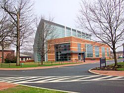
Hightstown is also home to the Peddie School, a coeducational, independent high school founded in 1864.
Historic district
|
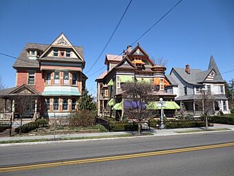
Stockton Street Historic District
|
|
 |
|
| Lua error in Module:Location_map at line 420: attempt to index field 'wikibase' (a nil value). | |
| Location | 126-326 Stockton Street, 219-237 Rogers Avenue, Hightstown, New Jersey |
|---|---|
| Architectural style | Queen Anne, Gothic, Italianate, Federal, Colonial |
| NRHP reference No. | 05001331 |
| Significant dates | |
| Added to NRHP | November 25, 2005 |
The Stockton Street Historic District covers both sides of Stockton Street (County Route 571), from Railroad Avenue to Summit Street, and a portion of Rogers Avenue. It is notable for its Victorian homes, First Methodist Church, and the Hightstown Civil War monument. It is also significant for its association with the introduction of rail service to New Jersey, as the first railroad in the United States to connect two major cities, New York and Philadelphia. With the historical significance of Hightstown, in July 2015 it became a Preserve America community, aimed at enriching the community's historic preservation efforts.
Infrastructure
Transportation
Roads and highways
As of May 2010[update], the borough had a total of 16.74 miles (26.94 km) of roadways, of which 12.70 miles (20.44 km) were maintained by the municipality, 2.74 miles (4.41 km) by Mercer County and 1.30 miles (2.09 km) by the New Jersey Department of Transportation.
Hightstown is located at the cross-roads of several major roads. The main highway through the borough is Route 33, which is also concurrent with County Route 539 (CR 539) and County Route 571 (CR 571). A small portion of U.S. Route 130 passes through the northwest corner and is accessible by Route 33, CR 571 and CR 539. Highways located just outside the borough include the New Jersey Turnpike (Interstate 95) and the "Hightstown Bypass" (Route 133), which both intersect with Route 33 at Exit 8 of the turnpike.
Public transportation
The Greater Mercer Transportation Management Association offers service on the Route 130 Connection between the Trenton Transit Center and South Brunswick. The Princeton Junction Shuttle connects East Windsor and Hightstown with the Princeton Junction Rail Station.
There is also direct service to New York, as well as other New Jersey communities on the Suburban Coach route 300 to and from the Port Authority Bus Terminal, Grand Central Terminal and other destinations in Midtown Manhattan and the 600 route to and from Downtown Manhattan / Wall Street.
Railroads
Hightstown was formerly served by the Camden & Amboy Railroad (C&A), the first chartered railway company in the state and the third-oldest in the United States. Service to Hightstown began in December 1831 using the British-built John Bull locomotive. C&A was acquired by the Pennsylvania Railroad (PRR) in 1871 after consolidating it with the United New Jersey Railroad and Canal Company. Ownership was later transferred to Penn Central (PC) in 1968, following by Conrail in 1976 after PC went bankrupt.
In early 1982, Conrail ended freight service to Hightstown on what was known as the Hightstown Industrial Track and filed for abandonment that fall. Trackage was removed in March 1983.
Healthcare
Hightstown is served by CentraState Healthcare System, a 287-bed regional hospital affiliated with Rutgers Robert Wood Johnson Medical School, located in nearby Freehold Township. CentraState Healthcare system also provides healthcare through its various family practices in communities across central New Jersey. One of those six family practices has an office located in neighboring East Windsor on U.S. Route 130.
The next closest hospitals to the borough include the Hamilton Division of Robert Wood Johnson University Hospital in Hamilton Township and Penn Medicine Princeton Medical Center in Plainsboro Township.
Ecology
According to the A. W. Kuchler U.S. potential natural vegetation types, Hightstown would have an Appalachian Oak (104) vegetation type with an Eastern Hardwood Forest (25) vegetation form.
Climate
According to the Köppen climate classification system, Hightstown has a hot-summer, wet all year, humid continental climate (Dfa). Dfa climates are characterized by at least one month having an average mean temperature at or below 32.0 °F (0.0 °C), at least four months with an average mean temperature at or above 50.0 °F (10.0 °C), at least one month with an average mean temperature at or above 71.6 °F (22.0 °C), and no significant precipitation difference between seasons. During the summer months, episodes of extreme heat and humidity can occur with heat index values at or above 100.0 °F (37.8 °C). On average, the wettest month of the year is July which corresponds with the annual peak in thunderstorm activity. During the winter months, episodes of extreme cold and wind can occur with wind chill values below 0.0 °F (−17.8 °C). The plant hardiness zone is 7a with an average annual extreme minimum air temperature of 0.0 °F (−17.8 °C). The average seasonal (November–April) snowfall total is 24 to 30 inches (61 to 76 cm), and the average snowiest month is February which corresponds with the annual peak in nor'easter activity.
| Climate data for Hightstown, Mercer County, New Jersey (1991–2020 normals, extremes 1893–present) | |||||||||||||
|---|---|---|---|---|---|---|---|---|---|---|---|---|---|
| Month | Jan | Feb | Mar | Apr | May | Jun | Jul | Aug | Sep | Oct | Nov | Dec | Year |
| Record high °F (°C) | 73 (23) |
77 (25) |
88 (31) |
95 (35) |
97 (36) |
100 (38) |
105 (41) |
102 (39) |
103 (39) |
95 (35) |
83 (28) |
76 (24) |
105 (41) |
| Mean maximum °F (°C) | 62.8 (17.1) |
62.8 (17.1) |
72.6 (22.6) |
84.3 (29.1) |
89.8 (32.1) |
93.6 (34.2) |
96.4 (35.8) |
94.3 (34.6) |
90.6 (32.6) |
81.9 (27.7) |
73.5 (23.1) |
65.3 (18.5) |
97.5 (36.4) |
| Mean daily maximum °F (°C) | 40.5 (4.7) |
43.0 (6.1) |
50.9 (10.5) |
62.9 (17.2) |
72.8 (22.7) |
81.7 (27.6) |
86.7 (30.4) |
84.9 (29.4) |
78.3 (25.7) |
66.4 (19.1) |
55.3 (12.9) |
45.5 (7.5) |
64.1 (17.8) |
| Daily mean °F (°C) | 31.0 (−0.6) |
32.8 (0.4) |
40.3 (4.6) |
51.0 (10.6) |
60.6 (15.9) |
69.8 (21.0) |
74.9 (23.8) |
72.9 (22.7) |
66.1 (18.9) |
54.3 (12.4) |
44.2 (6.8) |
36.1 (2.3) |
52.8 (11.6) |
| Mean daily minimum °F (°C) | 21.4 (−5.9) |
22.7 (−5.2) |
29.7 (−1.3) |
39.0 (3.9) |
48.4 (9.1) |
57.8 (14.3) |
63.0 (17.2) |
60.8 (16.0) |
53.8 (12.1) |
42.2 (5.7) |
33.0 (0.6) |
26.6 (−3.0) |
41.5 (5.3) |
| Mean minimum °F (°C) | 5.2 (−14.9) |
7.5 (−13.6) |
16.1 (−8.8) |
27.5 (−2.5) |
34.9 (1.6) |
45.3 (7.4) |
53.2 (11.8) |
50.6 (10.3) |
40.2 (4.6) |
28.4 (−2.0) |
19.4 (−7.0) |
12.9 (−10.6) |
2.8 (−16.2) |
| Record low °F (°C) | −16 (−27) |
−11 (−24) |
2 (−17) |
10 (−12) |
28 (−2) |
35 (2) |
42 (6) |
40 (4) |
28 (−2) |
22 (−6) |
0 (−18) |
−12 (−24) |
−16 (−27) |
| Average precipitation inches (mm) | 3.46 (88) |
2.61 (66) |
4.28 (109) |
3.67 (93) |
4.07 (103) |
4.63 (118) |
4.82 (122) |
4.29 (109) |
4.15 (105) |
3.98 (101) |
3.26 (83) |
4.23 (107) |
47.45 (1,205) |
| Average snowfall inches (cm) | 5.8 (15) |
8.0 (20) |
4.6 (12) |
0.6 (1.5) |
0.0 (0.0) |
0.0 (0.0) |
0.0 (0.0) |
0.0 (0.0) |
0.0 (0.0) |
0.0 (0.0) |
0.3 (0.76) |
4.4 (11) |
23.7 (60) |
| Average precipitation days (≥ 0.01 in) | 10.6 | 9.4 | 11.3 | 11.5 | 12.3 | 11.7 | 10.5 | 10.1 | 9.0 | 9.9 | 9.1 | 10.7 | 126.1 |
| Average snowy days (≥ 0.1 in) | 3.2 | 3.4 | 2.3 | 0.3 | 0.0 | 0.0 | 0.0 | 0.0 | 0.0 | 0.0 | 0.1 | 1.7 | 11.0 |
| Source: NOAA | |||||||||||||
Notable people
People who were born in, residents of, or otherwise closely associated with Hightstown include:
- Jim Barlow, soccer coach
- Kay B. Barrett (1902–1995), Hollywood talent scout who acquired the movie rights to the book Gone with the Wind
- Estelle Brodman (1914–2007), medical librarian and academic, lived in Hightstown after her retirement
- Howard Haycraft (1905–1991), writer, editor and publisher
- Hilly Kristal (1931–2007), founder and owner of the New York City music club CBGB
- Larry Kelley (1915–2000), football player who won the Heisman Trophy in 1936
- Desiree Lubovska (1893–1974), founded the American National Ballet School at Hightstown in 1921
- Doug Mastriano (born 1964), politician who is a retired Colonel of the United States Army and the state senator for Pennsylvania's 33rd District
- Worrall Frederick Mountain (1909–1992), Justice of the New Jersey Supreme Court from 1971 to 1979
- Elizabeth Greenleaf Pattee (1893–1991), architect, landscape architect and architecture professor
- Randal Pinkett (born 1971), business consultant who in 2005 was the winner of season four of the reality television show, The Apprentice
- Jonathan Sprout (born 1952), songwriter, performer and recording artist
- Martin Waldron (1925–1981), winner of the 1964 Pulitzer Prize for reporting on unchecked spending on the Florida Turnpike
- Charles L. Walters (c. 1862–1894), politician who served in the New Jersey General Assembly
- Paul Watkins (born 1964), novelist
- John Archibald Wheeler (1911–2008), physicist
- Nick Williams (born 1990), wide receiver who has played in the NFL for the Washington Redskins
- John Woodruff (1915–2007), Gold Medalist at 800 metres at the 1936 Summer Olympics in Berlin
See also
 In Spanish: Hightstown para niños


