High Amana, Iowa facts for kids
Quick facts for kids
High Amana, Iowa
|
|
|---|---|
| Country | United States |
| State | Iowa |
| County | Iowa |
| Area | |
| • Total | 0.38 sq mi (0.99 km2) |
| • Land | 0.38 sq mi (0.99 km2) |
| • Water | 0.00 sq mi (0.00 km2) |
| Elevation | 755 ft (230 m) |
| Population
(2020)
|
|
| • Total | 113 |
| • Density | 295.04/sq mi (113.94/km2) |
| Time zone | UTC-6 (Central (CST)) |
| • Summer (DST) | UTC-5 (CDT) |
| ZIP code |
52203
|
| Area code(s) | 319 |
| FIPS code | 19-36030 |
| GNIS feature ID | 457445 |
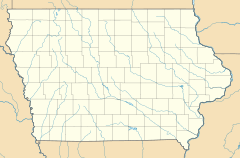
High Amana is an unincorporated community and census-designated place (CDP) in Iowa County, Iowa, United States, and is part of the "seven villages" of the Amana Colonies. As of the 2010 Census, the population of High Amana was 115.
Contents
Geography
High Amana is in northeastern Iowa County, 2 miles (3 km) west of Middle Amana and 1.5 miles (2.4 km) east of West Amana. It sits at the northern edge of the valley of the Iowa River. According to the U.S. Census Bureau, the High Amana CDP has an area of 0.39 square miles (1.00 km2), all land.
Demographics
| Historical population | |||
|---|---|---|---|
| Census | Pop. | %± | |
| 2020 | 113 | — | |
| U.S. Decennial Census | |||
History
This community was originally known as Hoch-Amana, German for "High Amana", also inflected as Hohe-Amana. Its full name was Amana vor der Höhe, lit. Amana in front of the height/hill.
In 1881, High Amana contained a general store, sawmill, machine shop, and a blacksmith shop.
See also
 In Spanish: High Amana (Iowa) para niños


