Harenkarspel facts for kids
Quick facts for kids
Harenkarspel
|
|||
|---|---|---|---|
|
Former municipality
|
|||
 |
|||
|
|||
 |
|||
| Country | Netherlands | ||
| Province | North Holland | ||
| Municipality | Schagen | ||
| Area
(2006)
|
|||
| • Total | 54.83 km2 (21.17 sq mi) | ||
| • Land | 54.03 km2 (20.86 sq mi) | ||
| • Water | 0.80 km2 (0.31 sq mi) | ||
| Population
(1 January 2007)
|
|||
| • Total | 15,922 | ||
| • Density | 295/km2 (760/sq mi) | ||
| Source: CBS, Statline. | |||
| Time zone | UTC+1 (CET) | ||
| • Summer (DST) | UTC+2 (CEST) | ||
| Website | www.harenkarspel.nl | ||
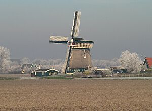
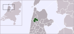
Harenkarspel (Dutch pronunciation: [ˈɦaːrə(ŋ)ˌkɑrspəl]) is a former municipality in the Netherlands, in the province of North Holland and the region of West-Frisia. The main town of Harenkarspel was Tuitjenhorn. In 2013, Harenkarspel merged with Schagen and Zijpe into a new municipality, called Schagen.
Population centres
The former municipality of Harenkarspel consisted of the following towns and villages: Dirkshorn, Eenigenburg, Groenveld, Kalverdijk, Kerkbuurt, Krabbendam, 't Rijpje, Schoorldam (partly), Sint Maarten, Stroet, Tuitjenhorn, Valkkoog, Waarland, and Warmenhuizen. Warmenhuizen and Tuitjenhorn were the largest, with the town hall of Harenkarspel located in Tuitjenhorn.
See also
 In Spanish: Harenkarspel para niños

All content from Kiddle encyclopedia articles (including the article images and facts) can be freely used under Attribution-ShareAlike license, unless stated otherwise. Cite this article:
Harenkarspel Facts for Kids. Kiddle Encyclopedia.


