Hanna, South Dakota facts for kids
Quick facts for kids
Hanna, South Dakota
|
|
|---|---|
| Country | United States |
| State | South Dakota |
| County | Lawrence |
| Elevation | 5,669 ft (1,728 m) |
| Time zone | UTC-7 (Mountain (MST)) |
| • Summer (DST) | UTC-6 (MDT) |
| Area code(s) | 605 |
| GNIS feature ID | 1261765 |
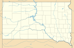
Hanna is a small unincorporated community in Lawrence County, South Dakota, United States. It is located along the Hanna Road in the Black Hills of South Dakota. The small settlement or village is south of the Hanna Campground and west-southwest of the Lead Country Club. The community is located about twelve miles southwest of Lead, South Dakota.
History
Hanna was founded in 1904. It was named in honor of a United States Senator, Marc Hanna of Ohio, who died shortly before the community was founded. At one time, a branch of the Chicago, Burlington & Quincy Railroad ran through the town. The community now contains a pumping station for the Homestake Mine.
Geography
Hanna is located at (44.261667, -103.844722).
Climate
North Rapid Creek is a SNOTEL weather station roughly 4.5 miles (7.2 km) south of Hanna, located near Buskala Historic Ranch.
| Climate data for North Rapid Creek, South Dakota, 1997–2020 normals, 1989-1997 snowfall: 6130ft (1868m) | |||||||||||||
|---|---|---|---|---|---|---|---|---|---|---|---|---|---|
| Month | Jan | Feb | Mar | Apr | May | Jun | Jul | Aug | Sep | Oct | Nov | Dec | Year |
| Mean daily maximum °F (°C) | 35.0 (1.7) |
35.5 (1.9) |
44.5 (6.9) |
49.8 (9.9) |
58.3 (14.6) |
69.0 (20.6) |
77.3 (25.2) |
75.5 (24.2) |
67.2 (19.6) |
52.3 (11.3) |
42.7 (5.9) |
34.0 (1.1) |
53.4 (11.9) |
| Daily mean °F (°C) | 25.6 (−3.6) |
24.8 (−4.0) |
33.1 (0.6) |
38.6 (3.7) |
47.0 (8.3) |
56.6 (13.7) |
64.2 (17.9) |
62.2 (16.8) |
54.6 (12.6) |
41.9 (5.5) |
33.0 (0.6) |
25.0 (−3.9) |
42.2 (5.7) |
| Mean daily minimum °F (°C) | 16.1 (−8.8) |
14.2 (−9.9) |
21.8 (−5.7) |
27.4 (−2.6) |
35.8 (2.1) |
44.2 (6.8) |
51.0 (10.6) |
48.9 (9.4) |
41.9 (5.5) |
31.6 (−0.2) |
23.4 (−4.8) |
16.0 (−8.9) |
31.0 (−0.5) |
| Average precipitation inches (mm) | 1.38 (35) |
1.34 (34) |
1.52 (39) |
2.61 (66) |
4.02 (102) |
3.43 (87) |
2.96 (75) |
2.00 (51) |
1.58 (40) |
2.29 (58) |
1.49 (38) |
1.25 (32) |
25.87 (657) |
| Average snowfall inches (cm) | 27.5 (70) |
23.6 (60) |
25.1 (64) |
38.5 (98) |
4.4 (11) |
0.8 (2.0) |
0.0 (0.0) |
0.0 (0.0) |
2.1 (5.3) |
16.2 (41) |
25.2 (64) |
31.5 (80) |
194.9 (495.3) |
| Source 1: XMACIS2 (temperature normals & Buskala Ranch snowfall) | |||||||||||||
| Source 2: NOAA (Precipitation) | |||||||||||||
| Climate data for Hanna, SD | |||||||||||||
|---|---|---|---|---|---|---|---|---|---|---|---|---|---|
| Month | Jan | Feb | Mar | Apr | May | Jun | Jul | Aug | Sep | Oct | Nov | Dec | Year |
| Record high °F (°C) | 69 (21) |
66 (19) |
74 (23) |
84 (29) |
88 (31) |
96 (36) |
99 (37) |
98 (37) |
96 (36) |
84 (29) |
74 (23) |
65 (18) |
99 (37) |
| Mean daily maximum °F (°C) | 36 (2) |
37 (3) |
43 (6) |
52 (11) |
61 (16) |
71 (22) |
79 (26) |
78 (26) |
68 (20) |
55 (13) |
43 (6) |
35 (2) |
55 (13) |
| Daily mean °F (°C) | 27 (−3) |
28 (−2) |
33 (1) |
42 (6) |
51 (11) |
60 (16) |
68 (20) |
67 (19) |
57 (14) |
45 (7) |
34 (1) |
26 (−3) |
45 (7) |
| Mean daily minimum °F (°C) | 17 (−8) |
18 (−8) |
23 (−5) |
31 (−1) |
40 (4) |
49 (9) |
56 (13) |
55 (13) |
45 (7) |
34 (1) |
24 (−4) |
16 (−9) |
34 (1) |
| Record low °F (°C) | −27 (−33) |
−32 (−36) |
−17 (−27) |
−5 (−21) |
9 (−13) |
24 (−4) |
36 (2) |
22 (−6) |
15 (−9) |
−5 (−21) |
−16 (−27) |
−33 (−36) |
−33 (−36) |
| Average precipitation inches (mm) | 1.34 (34) |
1.65 (42) |
2.58 (66) |
3.55 (90) |
4.64 (118) |
3.57 (91) |
2.76 (70) |
2.09 (53) |
1.99 (51) |
3.04 (77) |
1.83 (46) |
1.51 (38) |
30.55 (776) |
| Source: The Weather Channel (Historical Monthly Averages) | |||||||||||||


