Hand County, South Dakota facts for kids
Quick facts for kids
Hand County
|
|
|---|---|

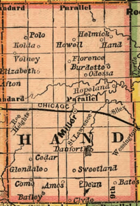
Hand County and its towns and villages in 1892
|
|

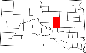
Location within the U.S. state of South Dakota
|
|
 South Dakota's location within the U.S. |
|
| Country | |
| State | |
| Founded | 1873 (created) 1882 (redrawn) 1882 (organized) |
| Named for | George A. Hand |
| Seat | Miller |
| Largest city | Miller |
| Area | |
| • Total | 1,440 sq mi (3,700 km2) |
| • Land | 1,437 sq mi (3,720 km2) |
| • Water | 3.6 sq mi (9 km2) 0.2% |
| Population
(2020)
|
|
| • Total | 3,145 |
| • Estimate
(2023)
|
3,107 |
| • Density | 2.184/sq mi (0.8433/km2) |
| Time zone | UTC−6 (Central) |
| • Summer (DST) | UTC−5 (CDT) |
| Congressional district | At-large |
Hand County is a county in the U.S. state of South Dakota. As of the 2020 census, the population was 3,145. Its county seat is Miller.
Contents
History
Hand County was named for George A. Hand, territorial secretary. It was created in 1873 by the Dakota territorial legislature. The boundaries were finalized in 1882, the year it was organized.
Geography
The terrain of Hand County consists of rolling hills, dotted with infrequent ponds and small lakes. Most of the area is devoted to agriculture. The terrain slopes to the east and northeast; its highest point is on the lower part of the county's west boundary line, at 2,080 ft (630 m) ASL. The county contains a total area of 1,440 square miles (3,700 km2), of which 1,437 square miles (3,720 km2) is land and 3.6 square miles (9.3 km2) (0.2%) is water.
Major highways
Adjacent counties
- Faulk County - north
- Spink County - northeast
- Beadle County - east
- Jerauld County - southeast
- Buffalo County - southwest
- Hyde County - west
Protected areas
- Collins State Game Production Area
- Dakota State Game Production Area
- East Pearl State Game Production Area
- Hawkins State Game Production Area
- Lake Jones State Game Production Area
- Lake Louise State Game Production Area
- Lake Louise State Recreation Area
- Lechtenberg State Game Production Area
- Reinhardt State Game Production Area
- Rosehill State Game Production Area
- Spring Lake State Game Production Area
- West Pearl State Game Production Area
Lakes
- Costigan Slough Lake
- Jones Lake
- Lake Louise
- Matter Lake
- Spring Lake
- Wall Lake
Demographics
| Historical population | |||
|---|---|---|---|
| Census | Pop. | %± | |
| 1880 | 153 | — | |
| 1890 | 6,346 | 4,047.7% | |
| 1900 | 4,525 | −28.7% | |
| 1910 | 7,870 | 73.9% | |
| 1920 | 8,778 | 11.5% | |
| 1930 | 9,485 | 8.1% | |
| 1940 | 7,166 | −24.4% | |
| 1950 | 7,149 | −0.2% | |
| 1960 | 6,712 | −6.1% | |
| 1970 | 5,883 | −12.4% | |
| 1980 | 4,948 | −15.9% | |
| 1990 | 4,272 | −13.7% | |
| 2000 | 3,741 | −12.4% | |
| 2010 | 3,431 | −8.3% | |
| 2020 | 3,145 | −8.3% | |
| 2023 (est.) | 3,107 | −9.4% | |
| U.S. Decennial Census 1790-1960 1900-1990 1990-2000 2010-2020 |
|||
2020 census
As of the 2020 census, there were 3,145 people, 1,348 households, and 891 families residing in the county. The population density was 2.2 inhabitants per square mile (0.85/km2). There were 1,705 housing units.
2010 census
As of the 2010 census, there were 3,431 people, 1,494 households, and 972 families residing in the county. The population density was 2.4 inhabitants per square mile (0.93/km2). There were 1,815 housing units at an average density of 1.3 units per square mile (0.50 units/km2). The racial makeup of the county was 98.4% white, 0.3% Asian, 0.2% American Indian, 0.1% black or African American, 0.2% from other races, and 0.8% from two or more races. Those of Hispanic or Latino origin made up 0.6% of the population. In terms of ancestry, 57.3% were German, 15.3% were Irish, 9.0% were Norwegian, 8.1% were English, 6.1% were Dutch, and 3.4% were American.
Of the 1,494 households, 23.8% had children under the age of 18 living with them, 56.6% were married couples living together, 5.3% had a female householder with no husband present, 34.9% were non-families, and 32.2% of all households were made up of individuals. The average household size was 2.26 and the average family size was 2.84. The median age was 48.2 years.
The median income for a household in the county was $45,895 and the median income for a family was $52,407. Males had a median income of $40,725 versus $24,844 for females. The per capita income for the county was $23,238. About 11.4% of families and 13.1% of the population were below the poverty line, including 18.9% of those under age 18 and 16.5% of those age 65 or over.
Communities
Cities
- Miller (county seat)
- Wessington (partial)
Towns
Census-designated place
- Millerdale Colony
Unincorporated communities
Source:
- Polo
- Vayland
Townships
- Alden
- Alpha
- Bates
- Burdette
- Campbell
- Carlton
- Cedar
- Como
- Florence
- Gilbert
- Glendale
- Grand
- Greenleaf
- Hiland
- Holden
- Hulbert
- Linn
- Logan
- Midland
- Miller
- Mondamin
- Ohio
- Ontario
- Park
- Pearl
- Plato
- Pleasant Valley
- Ree Heights
- Riverside
- Rockdale
- Rose Hill
- St. Lawrence
- Spring Hill
- Spring Lake
- Wheaton
- York
Unorganized territory
The county contains one area of unorganized territory: Northwest Hand.
See also
 In Spanish: Condado de Hand para niños

