Greensboro, Florida facts for kids
Quick facts for kids
Greensboro, Florida
|
|
|---|---|
| Town of Greensboro | |

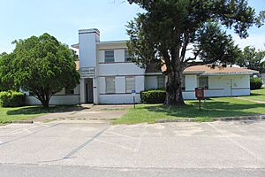
Greensboro Town Hall
|
|
| Motto(s):
"Welcome Home"
|
|

Location in Gadsden County and the state of Florida
|
|
| Country | |
| State | |
| County | Gadsden |
| Settled (Green's) | 1895 |
| Platted (Green's) | 1907 |
| Incorporated (Town of Greensboro) | 1911 |
| Government | |
| • Type | Mayor-Council |
| Area | |
| • Total | 2.30 sq mi (5.97 km2) |
| • Land | 2.30 sq mi (5.95 km2) |
| • Water | 0.01 sq mi (0.02 km2) |
| Elevation | 269 ft (82 m) |
| Population
(2020)
|
|
| • Total | 461 |
| • Density | 200.70/sq mi (77.48/km2) |
| Time zone | UTC-5 (Eastern (EST)) |
| • Summer (DST) | UTC-4 (EDT) |
| ZIP code |
32330
|
| Area code(s) | 850 |
| FIPS code | 12-27550 |
| GNIS feature ID | 0283424 |
Greensboro is a town in Gadsden County, Florida, United States. It is part of the Tallahassee Metropolitan Statistical Area. The population was 461 at the 2020 census, down from 602 at the 2010 census.
History
In 1895, J.W. Green bought 160 acres (64.7497 hectares) in Gadsden County. He built a house and farm, as well as a post office that he named after his land, "Green's". In 1907, the Apalachicola Northern Railroad built their train depot on his farmland, which made him decide to plat his land and transform it into a town. In 1911, it was officially incorporated as the "Town of Greensboro", in honor of Green.
Geography
The approximate coordinates for the Town of Greensboro is located in western Gadsden County at 30°34′10″N 84°44′40″W / 30.56944°N 84.74444°W (30.569333, –84.744560).
It is bordered to the northeast by the city of Gretna. Florida State Road 12 passes through the town center, leading east 10 miles (16 km) to Quincy, the county seat, and southwest 18 miles (29 km) to Bristol. Interstate 10 (Exit 174) is 3 miles (5 km) east of the center of town via SR 12; I-10 leads east 29 miles (47 km) to Tallahassee, the state capital.
According to the United States Census Bureau, Greensboro has a total area of 1.0 square mile (2.6 km2), all land.
Climate
The climate in this area is characterized by hot, humid summers and generally mild winters. According to the Köppen climate classification, the Town of Greensboro has a humid subtropical climate zone (Cfa).
Demographics
| Historical population | |||
|---|---|---|---|
| Census | Pop. | %± | |
| 1910 | 175 | — | |
| 1920 | 302 | 72.6% | |
| 1930 | 350 | 15.9% | |
| 1940 | 443 | 26.6% | |
| 1950 | 565 | 27.5% | |
| 1960 | 709 | 25.5% | |
| 1970 | 716 | 1.0% | |
| 1980 | 562 | −21.5% | |
| 1990 | 586 | 4.3% | |
| 2000 | 619 | 5.6% | |
| 2010 | 602 | −2.7% | |
| 2020 | 461 | −23.4% | |
| U.S. Decennial Census | |||
2010 and 2020 census
| Race | Pop 2010 | Pop 2020 | % 2010 | % 2020 |
|---|---|---|---|---|
| White (NH) | 136 | 112 | 22.59% | 24.30% |
| Black or African American (NH) | 163 | 124 | 27.08% | 26.90% |
| Native American or Alaska Native (NH) | 0 | 0 | 0.00% | 0.00% |
| Asian (NH) | 0 | 8 | 0.00% | 1.74% |
| Pacific Islander or Native Hawaiian (NH) | 0 | 0 | 0.00% | 0.00% |
| Some other race (NH) | 3 | 0 | 0.50% | 0.00% |
| Two or more races/Multiracial (NH) | 3 | 4 | 0.50% | 0.87% |
| Hispanic or Latino (any race) | 297 | 213 | 49.34% | 46.20% |
| Total | 602 | 461 |
As of the 2020 United States census, there were 461 people, 252 households, and 230 families residing in the town.
As of the 2010 United States census, there were 602 people, 267 households, and 159 families residing in the town.
Education
Gadsden County School District operates two public schools in the community: Greensboro Elementary School and West Gadsden Middle School; the elementary facility was formerly Greensboro High School. Gadsden County High School (formerly East Gadsden High School) serves high school students.
In 2017, the former West Gadsden High School was renamed to West Gadsden Middle School as all high school students were moved to East Gadsden High School. At that time grades 4–5 moved from Greensboro Elementary to West Gadsden Middle.
The Earl Willis Community Center houses a library.
Gallery
See also
 In Spanish: Greensboro (Florida) para niños


