Gordon Island facts for kids
|
Native name:
Isla Gordon
|
|
|---|---|

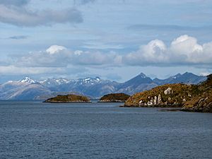
Gordon Island, seen from the Beagle Channel
|
|
| Geography | |
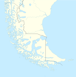
| Coordinates | 54°58′S 69°35′W / 54.967°S 69.583°W |
| Adjacent bodies of water | Beagle Channel, Pacific ocean |
| Area | 591 km2 (228 sq mi) |
| Coastline | 228.3 km (141.86 mi) |
| Highest point | 1548 |
| Administration | |
| Region | Magallanes |
| Province | Antártica Chilena |
| Commune | Cabo de Hornos |
| Additional information | |
| NGA UFI=-883298 | |
Gordon Island (Spanish: Isla Gordon) is an island in the Tierra del Fuego archipelago located between the Tierra del Fuego (Isla Grande) and the Hoste Island. It divides the Beagle Channel in two arms, the Northwest arm or Pomar Channel and the Southwest arm.
At the east end of the island is located the lighthouse Punta Divide.
See also
 In Spanish: Isla Gordon para niños
- List of islands of Chile
- Cabo de Hornos

All content from Kiddle encyclopedia articles (including the article images and facts) can be freely used under Attribution-ShareAlike license, unless stated otherwise. Cite this article:
Gordon Island Facts for Kids. Kiddle Encyclopedia.

