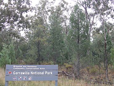
Garrawilla National Park facts for kids
Quick facts for kids Garrawilla National ParkNew South Wales |
|
|---|---|
|
IUCN Category II (National Park)
|
|

Garrawilla National Park
|
|
| Nearest town or city | Coonabarabran |
| Area | 9.37 km2 (3.62 sq mi) |
| Managing authorities | New South Wales National Parks and Wildlife Service |
| See also | Protected areas of New South Wales |
Garrawilla National Park was created in December 2005. It covers an area of 937 hectares. This park is located on the northern side of the Oxley Highway approximately halfway between Coonabarabran and Mullaley in New South Wales, Australia.

All content from Kiddle encyclopedia articles (including the article images and facts) can be freely used under Attribution-ShareAlike license, unless stated otherwise. Cite this article:
Garrawilla National Park Facts for Kids. Kiddle Encyclopedia.

