Fraxern facts for kids
Quick facts for kids
Fraxern
|
||
|---|---|---|
 |
||
|
||

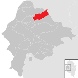
Location in the district
|
||
| Country | Austria | |
| State | Vorarlberg | |
| District | Feldkirch | |
| Area | ||
| • Total | 8.87 km2 (3.42 sq mi) | |
| Elevation | 817 m (2,680 ft) | |
| Time zone | UTC+1 (CET) | |
| • Summer (DST) | UTC+2 (CEST) | |
| Postal code |
6833
|
|
| Website | http://www.tisvover.at/fraxern/ | |
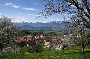
Fraxern is a municipality in the district of Feldkirch in the Austrian state of Vorarlberg.
Fraxern lies in the mountains next to Feldkirch at an altitude of 817 m. 54.6 % of the municipality is covered by forest and 26.7 % are meadows.
The first written mention of Fraxern ("Fraxnara", meaning ash), dates back to 1127.
Fraxern is famous for its cherries and its cherry schnaps.
Population
| Historical population | ||
|---|---|---|
| Year | Pop. | ±% |
| 1869 | 341 | — |
| 1880 | 367 | +7.6% |
| 1890 | 356 | −3.0% |
| 1900 | 373 | +4.8% |
| 1910 | 400 | +7.2% |
| 1923 | 413 | +3.2% |
| 1934 | 411 | −0.5% |
| 1939 | 394 | −4.1% |
| 1951 | 430 | +9.1% |
| 1961 | 473 | +10.0% |
| 1971 | 484 | +2.3% |
| 1981 | 519 | +7.2% |
| 1991 | 592 | +14.1% |
| 2001 | 659 | +11.3% |
| 2011 | 674 | +2.3% |
| 2012 | 671 | −0.4% |
| 2013 | 660 | −1.6% |
| 2014 | 656 | −0.6% |
| 2015 | 687 | +4.7% |
See also
 In Spanish: Fraxern para niños

All content from Kiddle encyclopedia articles (including the article images and facts) can be freely used under Attribution-ShareAlike license, unless stated otherwise. Cite this article:
Fraxern Facts for Kids. Kiddle Encyclopedia.


