Fostertown, New Jersey facts for kids
Quick facts for kids
Fostertown, New Jersey
|
|
|---|---|

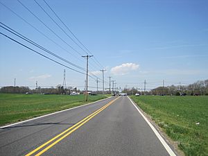
Fostertown Road
|
|
| Country | |
| State | |
| County | Burlington |
| Township | Lumberton |
| Elevation | 12 m (39 ft) |
| Time zone | UTC−05:00 (Eastern (EST)) |
| • Summer (DST) | UTC−04:00 (EDT) |
| Area code(s) | 609 |
| GNIS feature ID | 876429 |
Fostertown is an unincorporated community located within Lumberton Township in Burlington County, in the U.S. state of New Jersey. The site was founded in 1735 by William Foster, who established a plantation on modern-day West Bella Bridge Road. The area is largely farmland with some houses and a high-voltage power line dotting the landscape.
Transportation
County Route 541 is a major road that travels through the center of Fostertown.
The Flying W Airport is south of Fostertown, partially in Lumberton Township and neighboring Medford. The South Jersey Regional Airport is another airport located west of Fostertown.

All content from Kiddle encyclopedia articles (including the article images and facts) can be freely used under Attribution-ShareAlike license, unless stated otherwise. Cite this article:
Fostertown, New Jersey Facts for Kids. Kiddle Encyclopedia.


