Foothills County facts for kids
Quick facts for kids
Foothills County
Municipal District of Sheep River No. 31 (1954)
Municipal District of Foothills No. 31 (1954–2018) |
||
|---|---|---|
|
||

Location
|
||
| Country | Canada | |
| Province | Alberta | |
| Region | Calgary Region | |
| Census division | 6 | |
| Established | 1944 | |
| Incorporated | 1944 | |
| Name change | January 1, 2019 | |
| Area
(2021)
|
||
| • Land | 3,604.76 km2 (1,391.81 sq mi) | |
| Population
(2021)
|
||
| • Total | 23,199 | |
| • Density | 6.4/km2 (17/sq mi) | |
| Time zone | UTC−7 (MST) | |
| • Summer (DST) | UTC−6 (MDT) | |
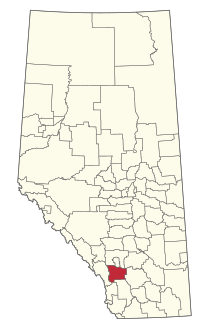
Foothills County is a municipal district in southern Alberta, Canada adjacent to the south side of Calgary in Census Division No. 6. Despite sharing a common border with the City of Calgary, it does not form part of the Calgary census metropolitan area (CMA) as defined by Statistics Canada. It is however a member municipality of the Calgary Metropolitan Region Board.
History
Foothills County was originally formed as the Municipal District (MD) of Sheep River No. 31 on January 1, 1954, through the amalgamation of portions of Improvement District No. 46 and the MDs of Highwood No. 31, Turner Valley No. 32, and Springbank No. 45. Its name was changed to the MD of Foothills No. 31 shortly thereafter on March 25, 1954. Foothills County assumed its present name on January 1, 2019.
Geography
Communities and localities
The following urban municipalities are surrounded by Foothills County.
|
The following hamlets are located within Foothills County. |
The following localities are located within Foothills County.
- Localities
|
|
Demographics
In the 2021 Census of Population conducted by Statistics Canada, Foothills County had a population of 23,199 living in 8,450 of its 9,075 total private dwellings, a change of 2.6% from its 2016 population of 22,616. With a land area of 3,604.76 km2 (1,391.81 sq mi), it had a population density of 6.4/km2 (17/sq mi) in 2021.
In the 2016 Census of Population conducted by Statistics Canada, Foothills County had a population of 22,766 living in 8,156 of its 8,689 total private dwellings, a 7.1% change from its 2011 population of 21,248. With a land area of 3,636.8 km2 (1,404.2 sq mi), it had a population density of 6.3/km2 (16/sq mi) in 2016.
Attractions
- Big Rock
- Cavalry FC
- De Winton/South Calgary Airport
- Frank Lake
- High River Airport
- Spruce Meadows


