Flemington, Georgia facts for kids
Quick facts for kids
Flemington, Georgia
|
|
|---|---|

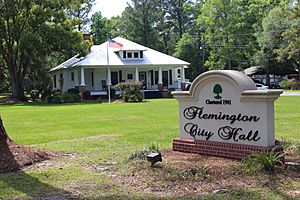
Flemington City Hall
|
|

Location in Liberty County and the state of Georgia
|
|
| Country | United States |
| State | Georgia |
| County | Liberty |
| Area | |
| • Total | 4.77 sq mi (12.35 km2) |
| • Land | 4.77 sq mi (12.34 km2) |
| • Water | 0.00 sq mi (0.00 km2) |
| Elevation | 20 ft (6 m) |
| Population
(2020)
|
|
| • Total | 825 |
| • Density | 173.10/sq mi (66.84/km2) |
| Time zone | UTC-5 (Eastern (EST)) |
| • Summer (DST) | UTC-4 (EDT) |
| ZIP code |
31313
|
| Area code(s) | 912 |
| FIPS code | 13-30088 |
| GNIS feature ID | 0355840 |
Flemington is a city in Liberty County, Georgia, United States. It is a part of the Hinesville-Fort Stewart metropolitan statistical area. The population was 825 in 2020.
Contents
History
A post office called Flemington was established in 1889, and remained in operation until 1966. The community was named after William Fleming, a pioneer settler. The Georgia General Assembly incorporated Flemington in 1941.
Geography
Flemington is located in central Liberty County at 31°51′23″N 81°33′40″W / 31.856356°N 81.561154°W. It is bordered to the west by Hinesville, the county seat. U.S. Route 84 passes through the center of Flemington, leading west into Hinesville and east 12 miles (19 km) to Interstate 95 on the east side of Midway.
According to the United States Census Bureau, Flemington has a total area of 4.7 square miles (12.3 km2), of which 0.86 acres (3,485 m2), or 0.03%, are water.
Demographics
| Historical population | |||
|---|---|---|---|
| Census | Pop. | %± | |
| 1950 | 90 | — | |
| 1960 | 149 | 65.6% | |
| 1970 | 265 | 77.9% | |
| 1980 | 440 | 66.0% | |
| 1990 | 279 | −36.6% | |
| 2000 | 369 | 32.3% | |
| 2010 | 743 | 101.4% | |
| 2020 | 825 | 11.0% | |
| U.S. Decennial Census | |||
In 2020, its population was 825.
Education
The Liberty County School District operates public schools that serve Flemington.
See also
 In Spanish: Flemington (Georgia) para niños

