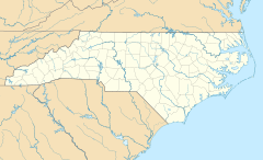
Farmington, North Carolina facts for kids
Quick facts for kids
Farmington, North Carolina
|
|
|---|---|
| Country | United States |
| State | North Carolina |
| County | Davie County |
| Area | |
| • Total | 1.66 sq mi (4.29 km2) |
| • Land | 1.62 sq mi (4.21 km2) |
| • Water | 0.03 sq mi (0.09 km2) |
| Elevation | 791 ft (241 m) |
| Population
(2020)
|
|
| • Total | 291 |
| • Density | 179.19/sq mi (69.20/km2) |
| Time zone | UTC-5 (Eastern (EST)) |
| • Summer (DST) | UTC-4 (EDT) |
| ZIP code |
27028
|
| Area code(s) | 336 |
| GNIS feature ID | 2812790 |
Farmington is an unincorporated community and census-designated place (CDP) in Davie County, North Carolina, United States, located at the intersection of NC 801 and Farmington Road (SR 1410). It was first listed as a CDP in the 2020 census with a population of 291. Located nearby is the Farmington Dragway.
Demographics
| Historical population | |||
|---|---|---|---|
| Census | Pop. | %± | |
| 2020 | 291 | — | |
| U.S. Decennial Census 2020 |
|||
2020 census
| Race / Ethnicity | Pop 2020 | % 2020 |
|---|---|---|
| White alone (NH) | 280 | 96.22% |
| Black or African American alone (NH) | 0 | 0.00% |
| Native American or Alaska Native alone (NH) | 0 | 0.00% |
| Asian alone (NH) | 0 | 0.00% |
| Pacific Islander alone (NH) | 0 | 0.00% |
| Some Other Race alone (NH) | 1 | 0.34% |
| Mixed Race/Multi-Racial (NH) | 5 | 1.72% |
| Hispanic or Latino (any race) | 5 | 1.72% |
| Total | 291 | 100.00% |
Note: the US Census treats Hispanic/Latino as an ethnic category. This table excludes Latinos from the racial categories and assigns them to a separate category. Hispanics/Latinos can be of any race.

All content from Kiddle encyclopedia articles (including the article images and facts) can be freely used under Attribution-ShareAlike license, unless stated otherwise. Cite this article:
Farmington, North Carolina Facts for Kids. Kiddle Encyclopedia.


