Evelyn, Queensland facts for kids
Quick facts for kids EvelynQueensland |
|||||||||||||||
|---|---|---|---|---|---|---|---|---|---|---|---|---|---|---|---|
| Population | 209 (2021 census) | ||||||||||||||
| • Density | 2.659/km2 (6.89/sq mi) | ||||||||||||||
| Postcode(s) | 4888 | ||||||||||||||
| Area | 78.6 km2 (30.3 sq mi) | ||||||||||||||
| Time zone | AEST (UTC+10:00) | ||||||||||||||
| LGA(s) | Tablelands Region | ||||||||||||||
| State electorate(s) | Hill | ||||||||||||||
| Federal Division(s) | Kennedy | ||||||||||||||
|
|||||||||||||||
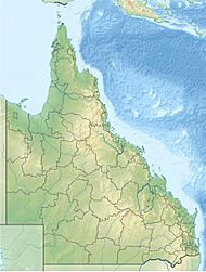
Evelyn is a rural locality in the Tablelands Region, Queensland, Australia. In the 2021 census, Evelyn had a population of 209 people.
Contents
History
The name Evelyn is taken from the name of an early pastoral run, which was named by Francis Horace Stubley (a Member of the Queensland Legislative Assembly in the Electoral district of Kennedy 1878-83), after his wife.
Evelyn Scrub Provisional School opened on 11 October 1895. On 1 January 1909, it became Evelyn Scrub State School. The school closed temporarily from 1918 to 1919. It closed permanently on 19 August 1946.
Geraldton Road State School opened on 1916. It closed on 1960. It was at 45 Geraldton Road (17°30′24″S 145°30′19″E / 17.50658°S 145.50540°E).
Demographics
In the 2011 census, Evelyn had a population of 330 people.
In the 2016 census, Evelyn had a population of 241 people.
In the 2021 census, Evelyn had a population of 209 people.
Geography
Longlands Gap–Herberton Road starts from the Kennedy Highway on the north-western boundary.
Heritage listings
Evelyn has a number of heritage-listed sites, including:
- Jonsson Road: Evelyn Scrub War Memorial
- off Jonsson Road: Cressbrook Cemetery


