Etobicoke Creek facts for kids
Quick facts for kids Etobicoke Creek |
|
|---|---|
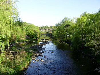
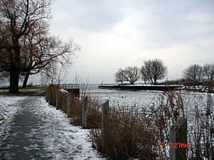
Looking north up Etobicoke Creek from Lake Shore Boulevard
|
|
|
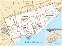
Location of the mouth of the creek in Toronto
|
|
| Country | Canada |
| Province | Ontario |
| Region | Greater Toronto Area |
| Municipalities |
|
| Physical characteristics | |
| Main source | Caledon, Regional Municipality of Peel 300 m (980 ft) 43°47′19″N 79°53′39″W / 43.78861°N 79.89417°W |
| River mouth | Lake Ontario Marie Curtis Park, Toronto 74 m (243 ft) 43°35′05″N 79°32′28″W / 43.58472°N 79.54111°W |
| Length | 61 km (38 mi) |
| Basin features | |
| Basin size | 211 km2 (81 sq mi) |
| Tributaries |
|
Etobicoke Creek is a river in the Greater Toronto Area of Ontario, Canada. It is a tributary of Lake Ontario and runs from Caledon to southern Etobicoke, part of the City of Toronto. The creek is within the jurisdiction of the Toronto and Region Conservation Authority.
Etymology
The name "Etobicoke" was derived from the Mississauga word wah-do-be-kang (wadoopikaang), meaning "place where the alders grow", which was used to describe the area between Etobicoke Creek and the Humber River. The first provincial land surveyor, Augustus Jones, also spelled it as "ato-be-coake". A letter from January 22, 1775 uses "Tobacock". Etobicoke was adopted as the official name of the township (later city, now part of the city of Toronto) in 1795 on the direction of Lieutenant Governor John Graves Simcoe. The name for the waterway used in the Toronto Purchase treaty was Etobicoke River. Simcoe in a memo from April 5, 1796 refers to it as "Smith River or Etobicoke". In a letter dated April 9, 1796 he used "Tobicoke". (No reference appears for Smith but could be linked to Samuel Smith who would be granted land in Etobicoke and served with Simcoe in the Queen's Rangers.) Both "creek" and "river" appear in newspapers and books until about 1960. "Creek" was officially adopted by the Geographical Names Board of Canada on November 18, 1962, though it existed far earlier.
Course
Etobicoke Creek begins south of the Oak Ridges Moraine and flows through Caledon, Brampton, and Mississauga — west of the Toronto Pearson International Airport and the surrounding industrial area — to its mouth at Lake Ontario in the Etobicoke portion of the city of Toronto. The length of the creek is 61 kilometres (38 mi).
Watershed
The creek's southern section forms a city and county-level boundary, separating Toronto on the east from Mississauga, in Peel Region, as far north as Eglinton Avenue (north of where it flows entirely through Peel), on the west. The watershed encompasses 211 square kilometres (81 sq mi). Mean summer waterflow has increased over the period 1967 to 2006 from 3.5 m3/s to 5.0 m3/s as recorded at a measuring station near the river mouth at the Queen Elizabeth Way.
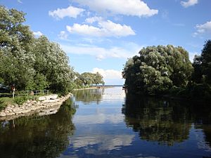
The creek ends in a large recreational area, Marie Curtis Park. It is surrounded by cliffs and the bottom is solid stone, often covered with smaller rocks. It is full of small fish and crayfish, a sign of purity of water.
Geology
The creek is characterized by winding paths ravines and shale banks.
Neighbourhoods
- Markland Wood is bounded by Etobicoke Creek to the west and Elmcrest (tributary) Creek to the east.
- Alderwood is bounded by Etobicoke Creek to the west.
- Long Branch is bounded on the west by Etobicoke Creek.
Tributaries
- Spring Creek - begins from Etobicoke Creek northwest of airport northwards between Torbram and Kennedy to about Bovaird.
- Little Etobicoke Creek
- Elmcrest Creek - small tributary that begins from two ponds inside Etobicoke Centennial Park and flows into Etobicoke Creek in the south at the Markland Wood Golf Club.
Gallery
-
Four mute swans along the bank of the Etobicoke Creek.
Images for kids


