Ermera facts for kids
This page is about the city. For the administrative post, see Ermera Administrative Post. For the municipality, see Ermera Municipality.
Quick facts for kids
Ermera
|
|
|---|---|
|
City
|
|

Main street and church of Ermera
|
|
| Country | |
| District | Ermera District |
| Subdistrict | Ermera Subdistrict |
| Suco | Poetete |
| Elevation | 1,195 m (3,921 ft) |
| Population
(2015 census)
|
|
| • Total | 8,907 |
| Time zone | UTC+9 (East Timor Standard Time) |
| Climate | Am |
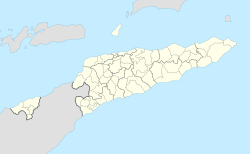
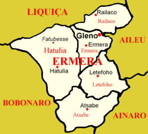
Ermera (Vila Ermera) is a city in East Timor and a former capital of the East Timorese community, Ermera. Ermera in Mambai means "red water." It has a population of 8,907. Its geographical coordinates are 8°45′8″S 125°23′49″E / 8.75222°S 125.39694°E, and it lies 1,195 metres (3,921 ft) above sea level. Ermera's center lies in the Suco of Poetete (Ermera Subdistrict, Ermera District).

All content from Kiddle encyclopedia articles (including the article images and facts) can be freely used under Attribution-ShareAlike license, unless stated otherwise. Cite this article:
Ermera Facts for Kids. Kiddle Encyclopedia.


