Enoch Cree Nation 135 facts for kids
Quick facts for kids
Enoch Cree Nation 135
|
|
|---|---|
| Enoch Cree Nation Indian Reserve No. 135 | |

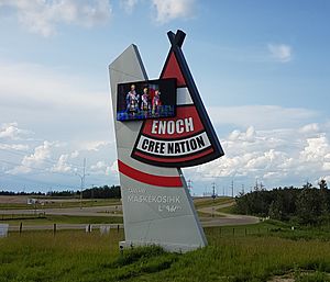
Welcome sign
|
|

Boundaries of Enoch Cree Nation 135
|
|

Location in Alberta
|
|
| First Nation | Enoch Cree |
| Treaty | 6 |
| Country | Canada |
| Province | Alberta |
| Municipal district | Parkland |
| Area | |
| • Total | 5,306.2 ha (13,111.9 acre) |
| Population
(2016)
|
|
| • Total | 1,690 |
| • Density | 32.8/km2 (85/sq mi) |
| Time zone | UTC−7 (MST) |
| • Summer (DST) | UTC−6 (MDT) |
| Postal Code |
T7X 3Y3
|
| Area code(s) | 780, 587 and 825 |
| Highways | 60, 628 |
Enoch Cree Nation 135, (Cree: ᒪᐢᑫᑯᓯᐦᐠ, romanized: maskêkosihk /məsˈkeɪɡoʊsiːk/) previously known as Stony Plain No. 135, is an Indian reserve of the Enoch Cree Nation #440 in Alberta. It is adjacent to the City of Edmonton to the east and Parkland County to the north, west, and south.
Geography
The locality of Enoch is on the Enoch Cree Nation 135 reserve.
Demographics
In 2016 Enoch Cree Nation 135 had a population of 1,690 living in 576 dwellings, a 71.2% increase from 2011. The Indian reserve has a land area of 51.55 km2 (19.90 sq mi) and a population density of 32.8/km2 (85/sq mi).
According to the Canada 2016 Census:
- Population: 1,690
- % Change (2011-2016): +71.2%
- Dwellings: 576
- Area (km2): 51.55
- Density (persons per km2): 32.8

All content from Kiddle encyclopedia articles (including the article images and facts) can be freely used under Attribution-ShareAlike license, unless stated otherwise. Cite this article:
Enoch Cree Nation 135 Facts for Kids. Kiddle Encyclopedia.

