Encinal, Texas facts for kids
Quick facts for kids
Encinal, Texas
|
|
|---|---|

Encinal water tower
|
|
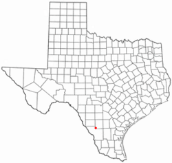
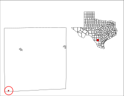
Location of Encinal, Texas
|
|
 |
|
| Country | United States |
| State | Texas |
| County | La Salle |
| Area | |
| • Total | 0.43 sq mi (1.12 km2) |
| • Land | 0.43 sq mi (1.12 km2) |
| • Water | 0.00 sq mi (0.00 km2) |
| Elevation | 558 ft (170 m) |
| Population
(2020)
|
|
| • Total | 540 |
| • Density | 1,256/sq mi (482/km2) |
| Time zone | UTC-6 (Central (CST)) |
| • Summer (DST) | UTC-5 (CDT) |
| ZIP code |
78019
|
| Area code(s) | 956 |
| FIPS code | 48-24240 |
| GNIS feature ID | 2410439 |
| Website | https://www.cityofencinal.com/ |
Encinal (/ˌɛnsɪˈnɔːl/ EN-sin-AWL) is a city in La Salle County, Texas, United States. The population was 540 at the 2020 census. Interstate 35 Business runs through the community. There are few businesses in Encinal; most have closed along the main street.
Railroad officials named the town for the Spanish word for oak grove. The population peaked in 1937 at eight hundred residents.
Contents
History
Encinal may be named for the Spanish word for a holm or holly oak grove. The town was supposed to be the county seat for Encinal County, which was established on February 1, 1856, and was to consist of the eastern portion of Webb County. The county was never organized and was finally dissolved on March 12, 1899. The Encinal territory was absorbed into Webb County, and Encinal became part of La Salle County.
Geography
Encinal is located at 28°2′28″N 99°21′17″W / 28.04111°N 99.35472°W.
According to the United States Census Bureau, the city has a total area of 0.4 square miles (1.0 km2), all land.
Climate
The climate in this area is characterized by hot, humid summers and generally mild to cool winters. According to the Köppen Climate Classification system, Encinal has a humid subtropical climate, abbreviated "Cfa" on climate maps.
| Climate data for Encinal, Texas (1991–2020 normals, extremes 1907–2020) | |||||||||||||
|---|---|---|---|---|---|---|---|---|---|---|---|---|---|
| Month | Jan | Feb | Mar | Apr | May | Jun | Jul | Aug | Sep | Oct | Nov | Dec | Year |
| Record high °F (°C) | 96 (36) |
101 (38) |
105 (41) |
110 (43) |
115 (46) |
116 (47) |
114 (46) |
112 (44) |
111 (44) |
105 (41) |
98 (37) |
98 (37) |
116 (47) |
| Mean daily maximum °F (°C) | 67.6 (19.8) |
72.4 (22.4) |
79.1 (26.2) |
86.6 (30.3) |
92.4 (33.6) |
97.9 (36.6) |
98.4 (36.9) |
99.7 (37.6) |
92.6 (33.7) |
86.1 (30.1) |
76.0 (24.4) |
67.6 (19.8) |
84.7 (29.3) |
| Daily mean °F (°C) | 55.2 (12.9) |
59.2 (15.1) |
65.2 (18.4) |
72.6 (22.6) |
79.3 (26.3) |
84.8 (29.3) |
85.7 (29.8) |
86.2 (30.1) |
81.0 (27.2) |
73.0 (22.8) |
63.5 (17.5) |
55.3 (12.9) |
71.8 (22.1) |
| Mean daily minimum °F (°C) | 42.9 (6.1) |
46.0 (7.8) |
51.3 (10.7) |
58.5 (14.7) |
66.3 (19.1) |
71.7 (22.1) |
73.0 (22.8) |
72.8 (22.7) |
69.5 (20.8) |
60.0 (15.6) |
51.0 (10.6) |
42.9 (6.1) |
58.8 (14.9) |
| Record low °F (°C) | 8 (−13) |
15 (−9) |
23 (−5) |
29 (−2) |
40 (4) |
51 (11) |
57 (14) |
60 (16) |
44 (7) |
31 (−1) |
21 (−6) |
11 (−12) |
8 (−13) |
| Average precipitation inches (mm) | 1.03 (26) |
1.08 (27) |
2.24 (57) |
1.93 (49) |
2.63 (67) |
2.38 (60) |
2.66 (68) |
1.63 (41) |
3.18 (81) |
2.45 (62) |
1.20 (30) |
1.13 (29) |
23.54 (598) |
| Average snowfall inches (cm) | 0.0 (0.0) |
0.0 (0.0) |
0.0 (0.0) |
0.0 (0.0) |
0.0 (0.0) |
0.0 (0.0) |
0.0 (0.0) |
0.0 (0.0) |
0.0 (0.0) |
0.0 (0.0) |
0.0 (0.0) |
0.3 (0.76) |
0.3 (0.76) |
| Average precipitation days (≥ 0.01 in) | 2.6 | 2.4 | 2.8 | 2.4 | 4.1 | 3.3 | 3.3 | 2.3 | 4.8 | 2.5 | 2.3 | 1.7 | 34.5 |
| Average snowy days (≥ 0.1 in) | 0.0 | 0.0 | 0.0 | 0.0 | 0.0 | 0.0 | 0.0 | 0.0 | 0.0 | 0.0 | 0.0 | 0.1 | 0.1 |
| Source: NOAA | |||||||||||||
Transportation
Highways
 Interstate Highway 35, exit 38, Runs directly through town to the east.
 Texas State Highway 44. Runs through town, Ends at US 83 far west of town.
 US 83. Bypasses town to the Far West.
Air travel
- Laredo International Airport (in Laredo)
Demographics
| Historical population | |||
|---|---|---|---|
| Census | Pop. | %± | |
| 1890 | 562 | — | |
| 1980 | 704 | — | |
| 1990 | 620 | −11.9% | |
| 2000 | 629 | 1.5% | |
| 2010 | 559 | −11.1% | |
| 2020 | 540 | −3.4% | |
| U.S. Decennial Census | |||
2020 census
| Race | Number | Percentage |
|---|---|---|
| White (NH) | 29 | 5.37% |
| Native American or Alaska Native (NH) | 1 | 0.19% |
| Mixed/Multi-Racial (NH) | 4 | 0.74% |
| Hispanic or Latino | 506 | 93.7% |
| Total | 540 |
As of the 2020 United States census, there were 540 people, 380 households, and 331 families residing in the city.
Education
- Encinal is within the Cotulla Independent School District.
Notable people
- Rodney Lewis, CEO of Lewis Energy, has a ranch in Encinal
- George Strait, country music artist lives on his 8,000+ acre ranch near Encinal
Gallery
-
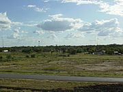
A glimpse of Encinal from Interstate 35.
See also
 In Spanish: Encinal (Texas) para niños


