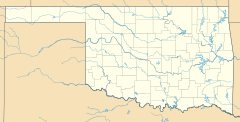
Emet, Oklahoma facts for kids
Quick facts for kids
Emet, Oklahoma
|
|
|---|---|
| Country | United States |
| State | Oklahoma |
| County | Johnston |
| Area | |
| • Total | 0.44 sq mi (1.13 km2) |
| • Land | 0.43 sq mi (1.13 km2) |
| • Water | 0.00 sq mi (0.00 km2) |
| Elevation | 810 ft (250 m) |
| Population
(2020)
|
|
| • Total | 69 |
| • Density | 158.62/sq mi (61.26/km2) |
| Time zone | UTC-6 (Central (CST)) |
| • Summer (DST) | UTC-5 (CDT) |
| FIPS code | 40-23850 |
| GNIS feature ID | 2812851 |
Emet is an unincorporated community and census-designated place in Johnston County, Oklahoma, United States. The population was 69 as of the 2020 Census. A post office operated in Emet from 1884 to 1917. The Chickasaw have dwelt in Johnston County since the 1830s, and Emet's history reflects its Chickasaw heritage. Pleasant Grove Mission School, which was established by the Methodist Episcopal Church in 1844 and served the Chickasaw Nation, was located near Emet. Chickasaw actress and storyteller Te Ata Fisher was born in Emet in 1895.
Douglas H. Johnston, the last governor of the Chickasaw Nation, lived in Emet. His home, known as the White House of the Chickasaws and now a museum, still stands on the north edge of the community though its formal street address is now in Milburn, Oklahoma.
Demographics
| Historical population | |||
|---|---|---|---|
| Census | Pop. | %± | |
| 2020 | 69 | — | |
| U.S. Decennial Census | |||


