Elk Hills Oil Field facts for kids


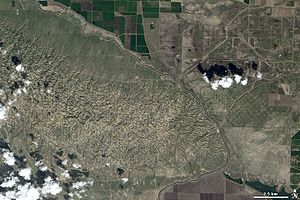
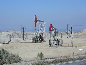
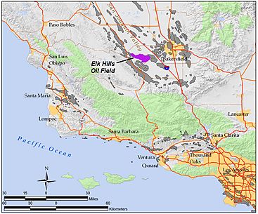
The Elk Hills Oil Field (formerly the Naval Petroleum Reserve No. 1) is a large oil field in western Kern County, in the Elk Hills of the San Joaquin Valley, California in the United States, about 20 miles (32 km) west of Bakersfield. Discovered in 1911, and having a cumulative oil production of close to 1.5 billion barrels (240,000 dam3) and a cumulative barrel of oil equivalent (which includes natural gas and condensate) production of 2.2 billion BOE at the end of 2023, it is the fifth-largest oil field in California, and the seventh-most productive field in the United States.
Its estimated remaining reserves, as of the end of 2023, were around 115 million barrels (18,300 dam3), and it had 2,387 active oil-producing wells. It is by an order of magnitude the largest natural gas-producing oil field in California, having produced over 4 trillion cubic feet (110 km3) of gas since its discovery, and retaining over 700 billion cubic feet (20,000,000 dam3) in reserve. It is larger than the Rio Vista Gas Field, the largest non-associated natural gas field in the state.
The principal operator of the field is California Resources Corporation. This company spun off in November 2014 from Occidental Petroleum.
Setting
The oil field underlies the Elk Hills, a range of low hills trending west to east with a high elevation of 1,551 feet (473 m). To the north, east, and southeast are the agricultural fields of the San Joaquin Valley, and to the southwest is the Buena Vista Valley. Across that valley is the town of Taft, and the enormous Midway-Sunset Oil Field, the largest in California. West of the Elk Hills is the large McKittrick Oil Field, and northwest is the even larger Cymric Oil Field. Although the Elk Hills is only one field of many in a region of oil fields, it is geographically distinct because its boundaries correspond with the shape of the hills that give it its name.
Skyline Road, which is closed to public entry, follows the long axis of the field. It begins near McKittrick and goes east, following the crest of the hills. Perpendicular to this road, and about halfway down its length, is Elk Hills Road, which connects the town of Taft to the south with Buttonwillow to the north. Two guarded gates to the California Resources Corporation operations, 3 and 4, make up the intersection with Skyline Road on the summit of the range.
Overall, the oil field is approximately 14 miles (23 km) long roughly following the crestline of the hills, and approximately 4 miles (6.4 km) across at the widest point. It encompasses 21,170 acres (85.7 km2) considered productive, or about 33 square miles (85 km2).
Geology
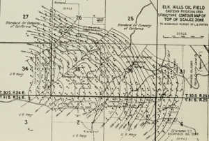
The Elk Hills Oil Field has a complex stratigraphy compared to other nearby fields, many of which are single large pools in simple structural traps. Thirteen separate oil pools have been identified so far in the Elk Hills Field, in rock units ranging in age from Oligocene to Pleistocene. The shallowest formation, the Tulare, was the first in which oil was found, at 1,120 feet (340 m) below ground surface, and the deepest, the Oligocene portion of the Temblor containing the Agua Pool at a depth of 9,500 feet (2,900 m), was not found until 1977.
Ecology
The oil neststraw (Stylocline citroleum), a rare flowering plant endemic to the Elk Hills area, was given its name because it is limited to oil field country.


