El Pla de Santa Maria facts for kids
Quick facts for kids
El Pla de Santa Maria
|
|||
|---|---|---|---|
|
Municipality
|
|||

St. Ramon's church
|
|||
|
|||
| Country | |||
| Community | |||
| Province | Tarragona | ||
| Comarca | Alt Camp | ||
| Area | |||
| • Total | 35.0 km2 (13.5 sq mi) | ||
| Elevation | 381 m (1,250 ft) | ||
| Population
(2018)
|
|||
| • Total | 2,305 | ||
| • Density | 65.86/km2 (170.57/sq mi) | ||
| Demonym(s) | Planenc | ||
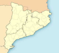
El Pla de Santa Maria (Catalan pronunciation: [əl ˈpla ðə ˈsantə məˈɾiə]) is a municipality in the comarca of the Alt Camp in Catalonia, Spain. It is situated at the foot of the Miramar range. The municipality is served by the A-2 motorway and is linked to Valls by the T-200 road.
See also
 In Spanish: Pla de Santa María para niños

All content from Kiddle encyclopedia articles (including the article images and facts) can be freely used under Attribution-ShareAlike license, unless stated otherwise. Cite this article:
El Pla de Santa Maria Facts for Kids. Kiddle Encyclopedia.


