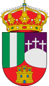
El Casar facts for kids
Quick facts for kids
El Casar
|
||
|---|---|---|
 |
||
|
||
| Country | Spain | |
| Region | Castile-La Mancha | |
| Province | Guadalajara | |
| Area | ||
| • Total | 51.84 km2 (20.02 sq mi) | |
| Elevation | 833 m (2,733 ft) | |
| Population
(2018)
|
||
| • Total | 11,812 | |
| • Density | 227.855/km2 (590.14/sq mi) | |
| Time zone | UTC+1 (CET) | |
| • Summer (DST) | UTC+2 (CEST) | |
El Casar (Spanish pronunciation: [el kaˈsaɾ]) is a municipality located in the province of Guadalajara, Castile-La Mancha, Spain.
Located in the border with the Community of Madrid, in the route of the N-320 road, it lies at 833 metres above sea level. The municipality covers an area of 51.84 km2.
As of 2018[update] it has a population of 11,812. El Casar is one of the municipalities in the province that experienced a great population increase in the late 20th century, in parallel to a huge increase in the urbanised area, through low-density residential developments, initially intended mainly for second homes. The population has roughly multiplied tenfold during the 1981–2011 period.
See also
 In Spanish: El Casar para niños

All content from Kiddle encyclopedia articles (including the article images and facts) can be freely used under Attribution-ShareAlike license, unless stated otherwise. Cite this article:
El Casar Facts for Kids. Kiddle Encyclopedia.

