Eastmain River Airport facts for kids
Quick facts for kids
Eastmain River Airport
|
|||||||||||
|---|---|---|---|---|---|---|---|---|---|---|---|
| Summary | |||||||||||
| Airport type | Public | ||||||||||
| Operator | Transport Canada Cree Nation of Eastmain |
||||||||||
| Location | Eastmain, Quebec | ||||||||||
| Time zone | EST (UTC−05:00) | ||||||||||
| • Summer (DST) | EDT (UTC−04:00) | ||||||||||
| Elevation AMSL | 24 ft / 7 m | ||||||||||
| Coordinates | 52°13′35″N 078°31′21″W / 52.22639°N 78.52250°W | ||||||||||
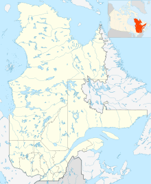
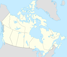
| Map | |||||||||||
| Runway | |||||||||||
|
|||||||||||
| Statistics (2010) | |||||||||||
|
|||||||||||
|
Source: Canada Flight Supplement
Movements from Statistics Canada |
|||||||||||
Eastmain River Airport (IATA: ZEM, ICAO: CZEM), is located 1 nautical mile (1.9 km; 1.2 mi) southwest of Eastmain, Quebec, Canada.
Airlines and destinations
| Airlines | Destinations |
|---|---|
| Air Creebec | Chibougamau, Chisasibi, Kuujjuarapik, Montreal–Trudeau, Nemaska, Val-d'Or, Waskaganish, Wemindji |
See also
 In Spanish: Aeropuerto de Eastmain River para niños

All content from Kiddle encyclopedia articles (including the article images and facts) can be freely used under Attribution-ShareAlike license, unless stated otherwise. Cite this article:
Eastmain River Airport Facts for Kids. Kiddle Encyclopedia.


