East Prairie Metis Settlement facts for kids
Quick facts for kids
East Prairie
|
|
|---|---|
|
Metis Settlement
|
|
| East Prairie Metis Settlement | |

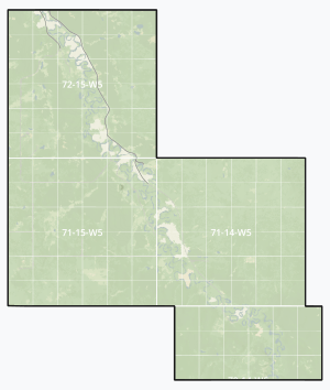
Boundaries of East Prairie
|
|

Location within Big Lakes County
|
|
| Country | Canada |
| Province | Alberta |
| Region | Northern Alberta |
| Planning region | Upper Athabasca |
| Municipal district | Big Lakes |
| Founded | 1939 |
| Area
(2021)
|
|
| • Land | 802.46 km2 (309.83 sq mi) |
| Population
(2021)
|
|
| • Total | 625 |
| • Density | 0.8/km2 (2/sq mi) |
| Time zone | UTC−7 (MST) |
| • Summer (DST) | UTC−6 (MDT) |
| Forward sortation area |
T0G
|
| Area code(s) | 780, 587, 825 |
East Prairie Metis Settlement is a Metis settlement in northern Alberta, Canada within Big Lakes County. It is located approximately 20 km (12 mi) south of Highway 2 and 168 km (104 mi) east of Grande Prairie. It was founded in 1939.
Chairperson, Raymond Supernault
Vice Chairperson, Doug Bellerose
Council Members, Delores Desjarlais, Keith Patenaude, Reva Jaycox
Demographics
As a designated place in the 2021 Census of Population conducted by Statistics Canada, East Prairie had a population of 310 living in 120 of its 148 total private dwellings, a change of 2% from its 2016 population of 304. With a land area of 328.42 km2 (126.80 sq mi), it had a population density of 0.9/km2 (2.3/sq mi) in 2021.
The population of the East Prairie Metis Settlement according to its 2018 municipal census is 491, an increase from its 2015 municipal census population count of 459.
As a designated place in the 2016 Census of Population conducted by Statistics Canada, the East Prairie Metis Settlement had a population of 304 living in 98 of its 157 total private dwellings, a change of -16.9% from its 2011 population of 366. With a land area of 334.44 km2 (129.13 sq mi), it had a population density of 0.9/km2 (2.3/sq mi) in 2016.


